Fraud Blocker Skip to main content

Map Making Collection (#8)

"Unveiling the Art of Map Making: A Journey Through Time and Space" Step into a world where cartography becomes an art form

Background imageMap Making Collection: Gerard Mercator (1512-94) engraved for inclusion in the Mercator

Gerard Mercator (1512-94) engraved for inclusion in the Mercator
3086636 Gerard Mercator (1512-94) engraved for inclusion in the Mercator and Hondius series of atlases, 1619 (engraving) (b/w photo) (see also 10457 and 174686) by Flemish School

Background imageMap Making Collection: Double portrait of Gerard Mercator (1512-94) and Jodocus Hondius (1563-1612

Double portrait of Gerard Mercator (1512-94) and Jodocus Hondius (1563-1612
XIR174686 Double portrait of Gerard Mercator (1512-94) and Jodocus Hondius (1563-1612) engraved for inclusion in the Mercator and Hondius series of atlases

Background imageMap Making Collection: Trade Card for Thomas Jefferys, Engraver, Geographer, and Printseller, 18th century

Trade Card for Thomas Jefferys, Engraver, Geographer, and Printseller, 18th century

Background imageMap Making Collection: Vera Effigies Guilielmi Burton / L. L. Baccalaurei, 1657-58. Creator: Wenceslaus Hollar

Vera Effigies Guilielmi Burton / L. L. Baccalaurei, 1657-58. Creator: Wenceslaus Hollar
Vera Effigies Guilielmi Burton / L.L. Baccalaurei, 1657-58

Background imageMap Making Collection: Trade card for John Dower, geographical engraver and draughtsman, 19th century

Trade card for John Dower, geographical engraver and draughtsman, 19th century

Background imageMap Making Collection: Copying Maps, Photographic Headquarters, Petersburg, Virginia, March 1865

Copying Maps, Photographic Headquarters, Petersburg, Virginia, March 1865

Background imageMap Making Collection: Matabeleland, 1900. Creator: Unknown

Matabeleland, 1900. Creator: Unknown
Matabeleland, 1900. From " South Africa and the Transvaal War, Vol. I", by Louis Creswicke. [T. C. & E. C. Jack, Edinburgh, 1900]

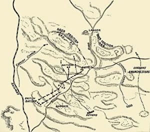
Background imageMap Making Collection: Top of Majuba - Scene of Action of Sunday 27th Feb 1881, 1900. Creator: Unknown

Top of Majuba - Scene of Action of Sunday 27th Feb 1881, 1900. Creator: Unknown
Top of Majuba - Scene of Action of Sunday 27th Feb 1881, 1900. From " South Africa and the Transvaal War, Vol. I", by Louis Creswicke. [T. C. & E. C. Jack, Edinburgh, 1900]

Background imageMap Making Collection: Map of Ladysmith and Surrounding Heights, 1900. Creator: Unknown

Map of Ladysmith and Surrounding Heights, 1900. Creator: Unknown
Map of Ladysmith and Surrounding Heights, 1900. From " South Africa and the Transvaal War, Vol. II", by Louis Creswicke. [T. C. & E. C. Jack, Edinburgh, 1900]

Background imageMap Making Collection: Map of Northern Natal. Scale 15 Statute Miles to the Inch, 1900. Creator: Unknown

Map of Northern Natal. Scale 15 Statute Miles to the Inch, 1900. Creator: Unknown
Map of Northern Natal. Scale 15 Statute Miles to the Inch, 1900. From " South Africa and the Transvaal War, Vol. II", by Louis Creswicke. [T. C. & E. C. Jack, Edinburgh, 1900]

Background imageMap Making Collection: Map of the Boer Republics, 1900. Creator: Unknown

Map of the Boer Republics, 1900. Creator: Unknown
Map of the Boer Republics, 1900. From " South Africa and the Transvaal War, Vol. I", by Louis Creswicke. [T. C. & E. C. Jack, Edinburgh, 1900]

Background imageMap Making Collection: Map Illustrating the Operations on the South of the Orange River, 1900. Creator: Unknown

Map Illustrating the Operations on the South of the Orange River, 1900. Creator: Unknown
Map Illustrating the Operations on the South of the Orange River, 1900. From " South Africa and the Transvaal War, Vol. II", by Louis Creswicke. [T. C. & E. C. Jack, Edinburgh, 1900]

Background imageMap Making Collection: Plan of battle of Elandslaagte, 1900. Creator: Unknown

Plan of battle of Elandslaagte, 1900. Creator: Unknown
Plan of battle of Elandslaagte, 1900. From " South Africa and the Transvaal War, Vol. II", by Louis Creswicke. [T. C. & E. C. Jack, Edinburgh, 1900]

Background imageMap Making Collection: Map of the Seat of War, 1900. Creator: Unknown

Map of the Seat of War, 1900. Creator: Unknown
Map of the Seat of War, 1900. From " South Africa and the Transvaal War, Vol. II", by Louis Creswicke. [T. C. & E. C. Jack, Edinburgh, 1900]

Background imageMap Making Collection: Map of Two and a Half Years Campaign in Mesopotamia, 1917. Creator: Unknown

Map of Two and a Half Years Campaign in Mesopotamia, 1917. Creator: Unknown
Map of Two and a Half Years Campaign in Mesopotamia, 1917. From " The War Illustrated Album De Luxe - Volume VIII. Ending The First Three Years", edited by J. A. Hammerton

Background imageMap Making Collection: Detailed Map of the Arras Fighting Area, 1917. Creator: Unknown

Detailed Map of the Arras Fighting Area, 1917. Creator: Unknown
Detailed Map of the Arras Fighting Area, 1917. From " The War Illustrated Album De Luxe - Volume VIII. Ending The First Three Years", edited by J. A. Hammerton

Background imageMap Making Collection: The Campaign in German East Africa, 1917. Creator: Unknown

The Campaign in German East Africa, 1917. Creator: Unknown
The Campaign in German East Africa, 1917. From " The War Illustrated Album De Luxe - Volume VIII. Ending The First Three Years", edited by J. A. Hammerton

Background imageMap Making Collection: The Great Arras Battle Area, 1917. Creator: Unknown

The Great Arras Battle Area, 1917. Creator: Unknown
The Great Arras Battle Area, 1917. From " The War Illustrated Album De Luxe - Volume VIII. Ending The First Three Years", edited by J. A. Hammerton

Background imageMap Making Collection: Map Showing German Retreat in the West, 1917, 1917. Creator: Unknown

Map Showing German Retreat in the West, 1917, 1917. Creator: Unknown
Map Showing German Retreat in the West, 1917, 1917. From " The War Illustrated Album De Luxe - Volume VIII. Ending The First Three Years", edited by J. A. Hammerton

Background imageMap Making Collection: Map of the World After Three Years of War, 1917. Creator: Unknown

Map of the World After Three Years of War, 1917. Creator: Unknown
Map of the World After Three Years of War, 1917.From " The War Illustrated Album De Luxe - Volume VIII. Ending The First Three Years", edited by J. A. Hammerton

Background imageMap Making Collection: The Battle of Messines, 1917. Creator: Unknown

The Battle of Messines, 1917. Creator: Unknown
The Battle of Messines, 1917. From " The War Illustrated Album De Luxe - Volume VIII. Ending The First Three Years", edited by J. A. Hammerton. [The Amalgamated Press, Limited, London, 1917]

Background imageMap Making Collection: The Roman Dominions in the Second Century B. C. with the dates of the Chief Acquistions, 1890

The Roman Dominions in the Second Century B. C. with the dates of the Chief Acquistions, 1890
The Roman Dominions in the Second Century B.C. with the dates of the Chief Acquistions, 1890. From " Cassells Illustrated Universal History Vol. II - Rome", by Edmund Ollier

Background imageMap Making Collection: Ancient Sicily and Southern Italy, 1890. Creator: Unknown

Ancient Sicily and Southern Italy, 1890. Creator: Unknown
Ancient Sicily and Southern Italy, 1890. From " Cassells Illustrated Universal History Vol. II - Rome", by Edmund Ollier. [Cassell and Company, Limited, London, Paris and Melbourne, 1890]

Background imageMap Making Collection: Map of Northern and Central Italy, 1890. Creator: Unknown

Map of Northern and Central Italy, 1890. Creator: Unknown
Map of Northern and Central Italy, 1890. From " Cassells Illustrated Universal History Vol. II - Rome", by Edmund Ollier. [Cassell and Company, Limited, London, Paris and Melbourne, 1890]

Background imageMap Making Collection: Map of Gaul and Part of Britain, 1890. Creator: Unknown

Map of Gaul and Part of Britain, 1890. Creator: Unknown
Map of Gaul and Part of Britain, 1890. From " Cassells Illustrated Universal History Vol. II - Rome", by Edmund Ollier. [Cassell and Company, Limited, London, Paris and Melbourne, 1890]

Background imageMap Making Collection: Asia Minor - Map, 1890. Creator: Unknown

Asia Minor - Map, 1890. Creator: Unknown
Asia Minor - Map, 1890. From " Cassells Illustrated Universal History Vol. II - Rome", by Edmund Ollier. [Cassell and Company, Limited, London, Paris and Melbourne, 1890]

Background imageMap Making Collection: English American Settlements - latter part of 17th Century, 1926. Creators: Unknown

English American Settlements - latter part of 17th Century, 1926. Creators: Unknown
English American Settlements - latter part of 17th Century, 1926. Map of the eastern coast of North America, the Caribbean and the north coast of South America, showing areas settled by Europeans

Background imageMap Making Collection: England & Wales in the Winter of 1643-44, 1926. Creators: Unknown, Emery Walker Ltd

England & Wales in the Winter of 1643-44, 1926. Creators: Unknown, Emery Walker Ltd
England & Wales in the Winter of 1643-44, 1926. Map showing England and Wales during the Civil War period. The key shows districts held by the king (Charles I), and by parliament

Background imageMap Making Collection: The Destruction of Roman Britain, 1926. Creators: Unknown, Emery Walker Ltd

The Destruction of Roman Britain, 1926. Creators: Unknown, Emery Walker Ltd
The Destruction of Roman Britain, 1926. Map of Britain showing invasions towards the end of the Roman period (43 to 410 AD)

Background imageMap Making Collection: England, Scotland and Ireland - Time of Viking Invasions, 1926. Creators: Unknown

England, Scotland and Ireland - Time of Viking Invasions, 1926. Creators: Unknown
England, Scotland and Ireland - Time of Viking Invasions, 1926. Map of Britain during the 9th-11th century. Towns of Viking foundation in Ireland underlined

Background imageMap Making Collection: The Great Western Railway, 1930. Creator: Unknown

The Great Western Railway, 1930. Creator: Unknown
The Great Western Railway, 1930. From " The Wonder Book of Railways", edited by Harry Golding. [Ward, Lock & Co. Limited, London and Melbourne, 1930]

Background imageMap Making Collection: The London and North Eastern Railway, 1930. Creator: Unknown

The London and North Eastern Railway, 1930. Creator: Unknown
The London and North Eastern Railway, 1930. From " The Wonder Book of Railways", edited by Harry Golding. [Ward, Lock & Co. Limited, London and Melbourne, 1930]

Background imageMap Making Collection: London Midland and Scottish Railway, 1930. Creator: Unknown

London Midland and Scottish Railway, 1930. Creator: Unknown
London Midland and Scottish Railway, 1930. From " The Wonder Book of Railways", edited by Harry Golding. [Ward, Lock & Co. Limited, London and Melbourne, 1930]

Background imageMap Making Collection: Map Showing Drakes Voyage of Circumnavigation (1577-1580), 1923. Creator: Unknown

Map Showing Drakes Voyage of Circumnavigation (1577-1580), 1923. Creator: Unknown
Map Showing Drakes Voyage of Circumnavigation (1577-1580), 1923. From " Australia, New Zealand and Oceania in Pictures", by H. Clive Barnard, M.A. Blitt. [A. & C

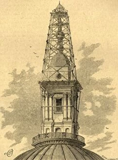
Background imageMap Making Collection: The Scaffolding and Observatory on St. Pauls in 1848, (1897). Creator: Unknown

The Scaffolding and Observatory on St. Pauls in 1848, (1897). Creator: Unknown
The Scaffolding and Observatory on St. Pauls in 1848, (1897). Observation post built by officers of the Royal Engineers on top of the cross on St Pauls Cathedral in London

Background imageMap Making Collection: Map of Europe, 1821. Creator: Unknown

Map of Europe, 1821. Creator: Unknown
Map of Europe, 1821. Map showing Germany, France, Italy, Spain and the British Isles in an intermediate Century between Antient and Modern Geography

Background imageMap Making Collection: Map of the Indian Ocean, 1902. Creator: Unknown

Map of the Indian Ocean, 1902. Creator: Unknown
Map of the Indian Ocean, 1902. Showing the coast of East Africa, Arabia, the Indian subcontinent, the Far East and part of Australia. From The Century Atlas of the World. [John Walker & Co, Ltd

Background imageMap Making Collection: Map of the World showing Heights and Depths, 1902. Creator: Unknown

Map of the World showing Heights and Depths, 1902. Creator: Unknown
Map of the World showing Heights and Depths, 1902. From The Century Atlas of the World. [John Walker & Co, Ltd. London, 1902]

Background imageMap Making Collection: Chart of the North Atlantic, 1902. Creator: Unknown

Chart of the North Atlantic, 1902. Creator: Unknown
Chart of the North Atlantic, 1902. Showing North and Central America, West Africa and Western Europe, and transatlantic shipping routes. From The Century Atlas of the World. [John Walker & Co, Ltd

Background imageMap Making Collection: Norman London, 1908

Norman London, 1908. From Early London - Prehistoric, Roman, Saxon and Norman, by Sir Walter Besant. [Adam & Charles Black, London, 1908]

Background imageMap Making Collection: Roman London, 1908

Roman London, 1908. From Early London - Prehistoric, Roman, Saxon and Norman, by Sir Walter Besant. [Adam & Charles Black, London, 1908]

Background imageMap Making Collection: The Marshes of Early London, 1908

The Marshes of Early London, 1908. From Early London - Prehistoric, Roman, Saxon and Norman, by Sir Walter Besant. [Adam & Charles Black, London, 1908]

Background imageMap Making Collection: The Situation of Westminster, 1908

The Situation of Westminster, 1908. From Early London - Prehistoric, Roman, Saxon and Norman, by Sir Walter Besant. [Adam & Charles Black, London, 1908]

Background imageMap Making Collection: Geological Map of the Site of London, 1908

Geological Map of the Site of London, 1908. From Early London - Prehistoric, Roman, Saxon and Norman, by Sir Walter Besant. [Adam & Charles Black, London, 1908]

Background imageMap Making Collection: Map of India - North Western Section

Map of India - North Western Section. Map showing Afghanistan and the Khyber Pass, what is now Pakistan, the Spin Ghar and Himalayan mountain ranges and parts of northern India

Background imageMap Making Collection: Map of the North Atlantic Ocean

Map of the North Atlantic Ocean. Map showing western Europen and Iceland, Greenland, eastern Canada and the United States, Central American and the Caribbean, and West Africa

Background imageMap Making Collection: Map of the North Polar Regions

Map of the North Polar Regions. Map of the Arctic Circle showing Iceland and Scandinavia, northern Russia, Greenland, northern Canada and Alaska. Plate 8 from The Times Atlas

Background imageMap Making Collection: Map of Persia

Map of Persia. Map of what is now known as Iran, showing the Persian Gulf. Plate 53 from The Times Atlas


All Professionally Made to Order for Quick Shipping

"Unveiling the Art of Map Making: A Journey Through Time and Space" Step into a world where cartography becomes an art form, as we explore the captivating realm of map making. From ancient marvels to modern masterpieces, these maps offer glimpses into different eras and regions, showcasing the evolution of this timeless craft. Travel back in time to the 13th century with "The Hereford Mappa Mundi, " a stunning medieval creation by Richard de Bello. This intricate masterpiece not only depicts geographical features but also incorporates religious symbolism, providing a unique insight into the beliefs and knowledge of that era. Fast forward to British South Africa in 1900, where an unknown creator crafted the "General Map of British South Africa. " With meticulous detail, it showcases vast landscapes and settlements during this pivotal period in history. Venture eastward to Japan through two enigmatic maps from 1903. The first reveals Japan's provinces during Iyeyasu's reign while the second portrays feudal Japan before Sekigahara. Though their creators remain anonymous, these maps offer valuable insights into Japanese history and territorial divisions. Closer to home lies John Bartholomew's artistic rendition of Isle of Wight from the early 20th century. His skillful brushstrokes bring life to this picturesque island off England's southern coast, capturing its beauty for generations to come. Delve further into historical cartography with John Ogilby and William Morgan's collaborative effort on "Map of Essex" from 1678. Their detailed work provides a glimpse into English county boundaries during that time period. Crossing oceans brings us to Martinique in the late 18th century with a map dating back to around 1783. This Caribbean gem is meticulously depicted on paper—a testament to both exploration and colonial influence during that era.