Fraud Blocker Skip to main content

Map Making Collection (#6)

"Unveiling the Art of Map Making: A Journey Through Time and Space" Step into a world where cartography becomes an art form

Background imageMap Making Collection: Russiae, Moskoviae et Tartariae descriptio, 1562. Creator: Anthony Jenkinson

Russiae, Moskoviae et Tartariae descriptio, 1562. Creator: Anthony Jenkinson
Russiae, Moskoviae et Tartariae descriptio, 1562. No. 1 Karta iz izdaniia: Atlas Aziatskoi Rossii.- SPb. Pereselencheskoe Upravlenie, kartogr. art. Zav. A.F. Marks, 1914

Background imageMap Making Collection: General Map of Kherson Province: Showing Postal and Major Roads, Stations and... 1821

General Map of Kherson Province: Showing Postal and Major Roads, Stations and... 1821
General Map of Kherson Province: Showing Postal and Major Roads, Stations and the Distance in Versts between Them, 1821. This 1821 map of Kherson Provinceis from a larger work

Background imageMap Making Collection: General Map of Courland Province: Showing Postal and Major Roads, Stations and the... 1820

General Map of Courland Province: Showing Postal and Major Roads, Stations and the... 1820
General Map of Courland Province: Showing Postal and Major Roads, Stations and the Distance in Versts between Them, 1820. This 1820 map of Courland Province is from a larger work

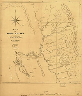
Background imageMap Making Collection: Map of the mining district of California, 1850. Creator: William A. Jackson

Map of the mining district of California, 1850. Creator: William A. Jackson
Map of the mining district of California, 1850. The California gold rush of 1849 began with the strikes at Sutter's Mill on the American River near Sacramento

Background imageMap Making Collection: General Map of Kiev Province: Showing Postal and Major Roads, Stations and.. 1821

General Map of Kiev Province: Showing Postal and Major Roads, Stations and.. 1821
General Map of Kiev Province: Showing Postal and Major Roads, Stations and the Distance in Versts between Them, 1821. This 1821 map of Kiev Province is from a larger work

Background imageMap Making Collection: General Map of Vilnius Province: Showing Postal and Major Roads, Stations and the... 1820

General Map of Vilnius Province: Showing Postal and Major Roads, Stations and the... 1820
General Map of Vilnius Province: Showing Postal and Major Roads, Stations and the Distance in Versts between Them, 1820. This 1820 map of Vilnius Provinceis from a larger work

Background imageMap Making Collection: Map of the mining district of California, 1851. Creator: William A. Jackson

Map of the mining district of California, 1851. Creator: William A. Jackson
Map of the mining district of California, 1851. This map, produced in two parts in the early years after the California Gold Rush of 1849

Background imageMap Making Collection: General Map of Grodno Province and the Belostok Region: Showing Postal and Major Roads... 1820

General Map of Grodno Province and the Belostok Region: Showing Postal and Major Roads... 1820
General Map of Grodno Province and the Belostok Region: Showing Postal and Major Roads, Stations and the Distance in Versts between Them, 1820

Background imageMap Making Collection: Vniversale descrittione di tvtta la terra conoscivta fin qvi, 1565

Vniversale descrittione di tvtta la terra conoscivta fin qvi, 1565. Creators: Paolo Forlani, Ferrando Bertelli
Vniversale descrittione di tvtta la terra conoscivta fin qvi, 1565. Relief shown pictorially. Based on an earlier map by Giacomo Gastaldi. From the Rosenwald Collection, Library of Congress, no

Background imageMap Making Collection: General Map of Podolsk Province: Showing Postal and Major Roads, Stations and the... 1820

General Map of Podolsk Province: Showing Postal and Major Roads, Stations and the... 1820
General Map of Podolsk Province: Showing Postal and Major Roads, Stations and the Distance in Versts between Them, 1820. This 1820 map of Podolsk Provinceis from a larger work

Background imageMap Making Collection: Topographical map of the road from Missouri to Oregon, commencing at the mouth of

Topographical map of the road from Missouri to Oregon, commencing at the mouth of the Kansas...1846 Creators
Topographical map of the road from Missouri to Oregon, commencing at the mouth of the Kansas in the Missouri River and ending at the mouth of the Walla-Wallah in the Columbia, 1846

Background imageMap Making Collection: General Map of the Russian Empire and the Neighboring Polish.. 1827

General Map of the Russian Empire and the Neighboring Polish.. 1827. Creators: Vasilii Petrovich Piadyshev, Ieremin
General Map of the Russian Empire and the Neighboring Polish Empire and Grand Duchy of Finland: With the Distance in Versts on Postal Roads between Provincial Cities;

Background imageMap Making Collection: The route of the Alaska excursion steamers, 1891. Creator: Charles Sumner Fee

The route of the Alaska excursion steamers, 1891. Creator: Charles Sumner Fee
The route of the Alaska excursion steamers, 1891. This map, published in 1891, shows the excursion steamship routes from Seattle

Background imageMap Making Collection: General Map of Yaroslavl Province: Showing Postal and Major Roads, Stations and the... 1822

General Map of Yaroslavl Province: Showing Postal and Major Roads, Stations and the... 1822
General Map of Yaroslavl Province: Showing Postal and Major Roads, Stations and the Distance in Versts between Them, 1822

Background imageMap Making Collection: Map of the Trans-Mississippi of the United States during the period of the American fur... 1902

Map of the Trans-Mississippi of the United States during the period of the American fur... 1902
Map of the Trans-Mississippi of the United States during the period of the American fur trade as conducted from St. Louis between the years 1807 and 1843, 1902. This map, published in 1902 in H.M

Background imageMap Making Collection: General Map of Mogilev Province: Showing Postal and Major Roads, Stations and... 1821

General Map of Mogilev Province: Showing Postal and Major Roads, Stations and... 1821
General Map of Mogilev Province: Showing Postal and Major Roads, Stations and the Distance in Versts between Them, 1821. This 1821 map of Mogilev Provinceis from a larger work

Background imageMap Making Collection: General Map of Voronezh Province: Showing Postal and Major Roads, Stations and the... 1822

General Map of Voronezh Province: Showing Postal and Major Roads, Stations and the... 1822
General Map of Voronezh Province: Showing Postal and Major Roads, Stations and the Distance in Versts between Them, 1822. This 1822 map of Voronezh Provinceis from a larger work

Background imageMap Making Collection: Going to Klondyke, 1897. Creator: May Bloom

Going to Klondyke, 1897. Creator: May Bloom
Going to Klondyke, 1897. The Klondike Gold Rush of 1898 was one of the largest gold frenzies in history. Tens of thousands of prospectors from around the world streamed north to Alaska

Background imageMap Making Collection: General Map of Tambov Province: Showing Postal and Major Roads, Stations and the... 1822

General Map of Tambov Province: Showing Postal and Major Roads, Stations and the... 1822
General Map of Tambov Province: Showing Postal and Major Roads, Stations and the Distance in Versts between Them, 1822. This 1822 map of Tambov Provinceis from a larger work

Background imageMap Making Collection: Dickson'in sataman. Kartta. G. Boven tekema, 1878. Creator: G. Boven

Dickson'in sataman. Kartta. G. Boven tekema, 1878. Creator: G. Boven
Dickson'in sataman. Kartta. G. Boven tekema, 1878. Dikson, o-v. Karta puteshestvii?a? Nordenshel'da na karable "Vega" u beregov Diksona v 1878 godu

Background imageMap Making Collection: General Map of the Polish Empire: Showing Postal and Major Roads, Stations and the... 1820

General Map of the Polish Empire: Showing Postal and Major Roads, Stations and the... 1820
General Map of the Polish Empire: Showing Postal and Major Roads, Stations and the Distance in Miles Between Them, 1820. This 1820 map of the Polish Empire, then part of the Russian Empire

Background imageMap Making Collection: Map of the United States, the British provinces, Mexico &c. 1849. Creator: John M. Atwood

Map of the United States, the British provinces, Mexico &c. 1849. Creator: John M. Atwood
Map of the United States, the British provinces, Mexico &c. 1849. Shows California's gold region and western trails. Includes illustration of "Pyramid Lake

Background imageMap Making Collection: General Map of Kostroma Province: Showing Postal and Major Roads, Stations and... 1822

General Map of Kostroma Province: Showing Postal and Major Roads, Stations and... 1822
General Map of Kostroma Province: Showing Postal and Major Roads, Stations and the Distance in Versts between Them, 1822. This 1822 map of Kostroma Provinceis from a larger work

Background imageMap Making Collection: The Alaska Line, 1934. Creator: Alaska Steamship Co

The Alaska Line, 1934. Creator: Alaska Steamship Co
The Alaska Line, 1934. This map, published in 1934 for the tourist market with colorful images and motifs, shows various shipping routes of the Alaska Line

Background imageMap Making Collection: General Map of Orel Province: Showing Postal and Major Roads, Stations and... 1822

General Map of Orel Province: Showing Postal and Major Roads, Stations and... 1822
General Map of Orel Province: Showing Postal and Major Roads, Stations and the Distance in Versts between Them, 1822. This 1822 map of Orel Province is from a larger work

Background imageMap Making Collection: General Map of Taurida Province: Showing Postal and Major Roads, Stations and.. 1822

General Map of Taurida Province: Showing Postal and Major Roads, Stations and.. 1822
General Map of Taurida Province: Showing Postal and Major Roads, Stations and the Distance in Versts between Them, 1822. This 1822 map ofTaurida Provinceis from a larger work

Background imageMap Making Collection: General Map of Ryazan Province: Showing Postal and Major Roads, Stations and... 1822

General Map of Ryazan Province: Showing Postal and Major Roads, Stations and... 1822
General Map of Ryazan Province: Showing Postal and Major Roads, Stations and the Distance in Versts between Them, 1822. This 1822 map of Ryazan Provinceis from a larger work

Background imageMap Making Collection: General Map of Tula Province: Showing Postal and Major Roads, Stations and... 1822

General Map of Tula Province: Showing Postal and Major Roads, Stations and... 1822
General Map of Tula Province: Showing Postal and Major Roads, Stations and the Distance in Versts between Them, 1822. This 1822 map of Tula Provinceis from a larger work

Background imageMap Making Collection: General Map of Estland Province: Showing Postal and Major Roads, Stations and... 1820

General Map of Estland Province: Showing Postal and Major Roads, Stations and... 1820
General Map of Estland Province: Showing Postal and Major Roads, Stations and the Distance in Versts between Them, 1820. This 1820 map of Estland Province is from a larger work

Background imageMap Making Collection: General Map of Volhynia Province: Showing Postal and Major Roads, Stations... 1820

General Map of Volhynia Province: Showing Postal and Major Roads, Stations... 1820
General Map of Volhynia Province: Showing Postal and Major Roads, Stations and the Distance in Versts between Them, 1820. This 1820 map of Volhynia Provinceis from a larger work

Background imageMap Making Collection: The Isle of Anglesey, The Isle of Man and the Isle of Wight, 1650, (1946). Creator: Unknown

The Isle of Anglesey, The Isle of Man and the Isle of Wight, 1650, (1946). Creator: Unknown
The Isle of Anglesey, The Isle of Man and the Isle of Wight, 1650, (1946). Three maps of islands off the coast of Britain

Background imageMap Making Collection: Plan of the Osaka Second or Summer Campaign, 1615. 1903. Creator: Unknown

Plan of the Osaka Second or Summer Campaign, 1615. 1903. Creator: Unknown
Plan of the Osaka Second or Summer Campaign, 1615, 1903. The siege of Osaka was a series of battles by the Tokugawa shogunate against the Toyotomi clan

Background imageMap Making Collection: Plan of the Osaka First or Winter Campaign, 1614, 1903. Creator: Unknown

Plan of the Osaka First or Winter Campaign, 1614, 1903. Creator: Unknown
Plan of the Osaka First or Winter Campaign, 1614, 1903. The siege of Osaka was a series of battles by the Tokugawa shogunate against the Toyotomi clan

Background imageMap Making Collection: Tokaido & Nakasendo to illustrate the Sekigahara Campaign, 1903. Creator: Unknown

Tokaido & Nakasendo to illustrate the Sekigahara Campaign, 1903. Creator: Unknown
Tokaido & Nakasendo to illustrate the Sekigahara Campaign, 1903. The Battle of Sekigahara, October 21, 1600 led to establishment of the Tokugawa shogunate

Background imageMap Making Collection: Plan of Jerusalem in the First Christian Century, 1890. Creator: Unknown

Plan of Jerusalem in the First Christian Century, 1890. Creator: Unknown
Plan of Jerusalem in the First Christian Century, 1890. From " Cassells Illustrated Universal History Vol. II - Rome", by Edmund Ollier

Background imageMap Making Collection: Celtic and Roman Britain, 1926. Creator: Emery Walker Ltd

Celtic and Roman Britain, 1926. Creator: Emery Walker Ltd
Celtic and Roman Britain, 1926. Map of Britain during the Roman (43 to 410 AD) and Celtic periods. All the forts and towns here marked had roads to them, even in the Welsh mountains

Background imageMap Making Collection: Map of the World, According to Ptolemy, 1923. Creator: Agathodaemon of Alexandria

Map of the World, According to Ptolemy, 1923. Creator: Agathodaemon of Alexandria
Map of the World, According to Ptolemy, 1923. From " Australia, New Zealand and Oceania in Pictures", by H. Clive Barnard, M.A. Blitt. [A. & C. Black, Limited, London, 1923]

Background imageMap Making Collection: Commercial Map of the World, 1902. Creator: Unknown

Commercial Map of the World, 1902. Creator: Unknown
Commercial Map of the World, 1902. With shipping routes. From The Century Atlas of the World. [John Walker & Co, Ltd. London, 1902]

Background imageMap Making Collection: Map of the Indian Ocean

Map of the Indian Ocean. Map showing the Indian subcontinent, East Africa, the Arabian peninsula, Indo-China and Western Australia. Plate 54 from The Times Atlas

Background imageMap Making Collection: Map of Southern Russia

Map of Southern Russia. Map showing the Black Sea, the Caspian Sea, Turkey, Bulgaria, Romania, the Ukraine, Georgia and Azerbaijan. Plate 46 from The Times Atlas

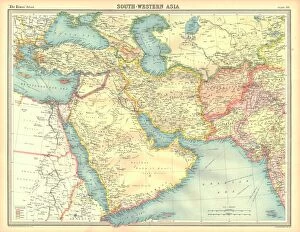
Background imageMap Making Collection: Political map of South Western Asia

Political map of South Western Asia. Map of the Near and Middle East, showing parts of East Africa and the Arabian Peninsula. Plate 50 from The Times Atlas

Background imageMap Making Collection: Geographical map of the north-eastern section of India, early 20th century

Geographical map of the north-eastern section of India, early 20th century. Pre-partition map showing the Bay of Bengal and the Ganges Delta, and what are now Bangladesh and Myanmar

Background imageMap Making Collection: Map of Victoria and Tasmania

Map of Victoria and Tasmania. Map showing a southern section of Australia, Melbourne, the Bass Strait and the island of Tasmania. Plate 107 from The Times Atlas

Background imageMap Making Collection: Political map of China

Political map of China. Map showing China, Mongolia, East Turkestan, Tibet and the Korean peninsula. Plate 62 from The Times Atlas

Background imageMap Making Collection: Political map of Eastern China

Political map of Eastern China, showing Taiwan, Tianjin and the Bohai Sea. Plate 64 from The Times Atlas

Background imageMap Making Collection: Map of Magellans round the world voyage, 1519-1521

Map of Magellans round the world voyage, 1519-1521. A Portuguese-born navigator sponsored by Spain, Ferdinand Magellan (c1480-1521)

Background imageMap Making Collection: Flower Garden - Lewis Estate, c. 1936. Creator: Virginia Richards

Flower Garden - Lewis Estate, c. 1936. Creator: Virginia Richards
Flower Garden - Lewis Estate, c. 1936

Background imageMap Making Collection: Parmentier Grounds, c. 1936. Creator: Virginia Richards

Parmentier Grounds, c. 1936. Creator: Virginia Richards
Parmentier Grounds, c. 1936


All Professionally Made to Order for Quick Shipping

"Unveiling the Art of Map Making: A Journey Through Time and Space" Step into a world where cartography becomes an art form, as we explore the captivating realm of map making. From ancient marvels to modern masterpieces, these maps offer glimpses into different eras and regions, showcasing the evolution of this timeless craft. Travel back in time to the 13th century with "The Hereford Mappa Mundi, " a stunning medieval creation by Richard de Bello. This intricate masterpiece not only depicts geographical features but also incorporates religious symbolism, providing a unique insight into the beliefs and knowledge of that era. Fast forward to British South Africa in 1900, where an unknown creator crafted the "General Map of British South Africa. " With meticulous detail, it showcases vast landscapes and settlements during this pivotal period in history. Venture eastward to Japan through two enigmatic maps from 1903. The first reveals Japan's provinces during Iyeyasu's reign while the second portrays feudal Japan before Sekigahara. Though their creators remain anonymous, these maps offer valuable insights into Japanese history and territorial divisions. Closer to home lies John Bartholomew's artistic rendition of Isle of Wight from the early 20th century. His skillful brushstrokes bring life to this picturesque island off England's southern coast, capturing its beauty for generations to come. Delve further into historical cartography with John Ogilby and William Morgan's collaborative effort on "Map of Essex" from 1678. Their detailed work provides a glimpse into English county boundaries during that time period. Crossing oceans brings us to Martinique in the late 18th century with a map dating back to around 1783. This Caribbean gem is meticulously depicted on paper—a testament to both exploration and colonial influence during that era.