Fraud Blocker Skip to main content

Cartographer Collection (#7)

"Unveiling the World

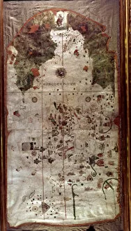
Background imageCartographer Collection: Map of Spain, 1500, work by the Spanish cartographer and pilot Juan de la Cosa

Map of Spain, 1500, work by the Spanish cartographer and pilot Juan de la Cosa

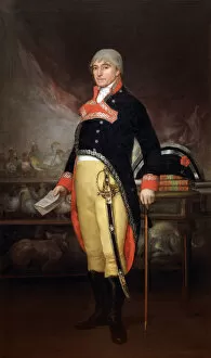
Background imageCartographer Collection: Felix de Azara (1742-1821), Spanish naval officer

Felix de Azara (1742-1821), Spanish naval officer

Background imageCartographer Collection: Partie de la Nouvelle France ou du Canada

Partie de la Nouvelle France ou du Canada
Canada Map 1762

Background imageCartographer Collection: Peter Perez Burdett and his first wife Hannah, 1765, by Jose

Peter Perez Burdett and his first wife Hannah, 1765, by Jose
Peter Perez Burdett (c.1734-1793). English cartographer and artist. Peter Perez Burdett and his first wife Hannah, 1765, portrait by Joseph Wright of Derby (1734-1794)

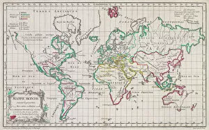
Background imageCartographer Collection: Map Of The World World Map Religions Cartography

Map Of The World World Map Religions Cartography
Map of the World. Religions are indicated by colour. After a work dated 1761 of French cartographer Gilles Robert de Vaugondy

Background imageCartographer Collection: Hand coloured, world map by Gerard van Schagen, published in Amsterdam in the 1680s as Nova totius

Hand coloured, world map by Gerard van Schagen, published in Amsterdam in the 1680s as Nova totius terrarum orbis tabula ex officina G. A. Schagen Amstelodami

Background imageCartographer Collection: After a map from 1671 of the Americas by Dutch cartographer Gerard van Schagen

After a map from 1671 of the Americas by Dutch cartographer Gerard van Schagen. It shows California as an island. Its full name is Novissima et Accuratissima Totius Americae Descriptio

Background imageCartographer Collection: Graeciae pars meridionalis. Graeciae antiquae tabula nova. Southern Greece

Graeciae pars meridionalis. Graeciae antiquae tabula nova. Southern Greece. A New Map of Ancient Greece. Parts of Asian Turkey are also shown

Background imageCartographer Collection: The death of Captain James Cook at Kealakekua Bay, Hawaii, February 17, 1779

The death of Captain James Cook at Kealakekua Bay, Hawaii, February 17, 1779. James Cook, 1728 - 1779. Captain in the British Royal Navy, explorer, navigator and cartographer

Background imageCartographer Collection: England and Wales in the late 18th century. After a map by cartographer and publisher William Faden

England and Wales in the late 18th century. After a map by cartographer and publisher William Faden, engraved by William Palmer

Background imageCartographer Collection: Title page of the Murr reprint (1790) of the Christianismi Restitutio of Servetus, 1553

Title page of the Murr reprint (1790) of the Christianismi Restitutio of Servetus, 1553. The reprint is now almost as scarce as the original. Michael Servetus, 1509/1511 -1553

Background imageCartographer Collection: Nathaniel Nye, 1624 - after 1647. English mathematician, astronomer, cartographer

Nathaniel Nye, 1624 - after 1647. English mathematician, astronomer, cartographer

Background imageCartographer Collection: Map of America by cartographer John Speed published circa 1627. The cartouche, lower left

Map of America by cartographer John Speed published circa 1627. The cartouche, lower left, reads: America with those known parts in that unknowne worlde both people and manner of buildings

Background imageCartographer Collection: Gerardus Mercator, 1512 - 1594. 16th-century geographer, cosmographer and cartographer

Gerardus Mercator, 1512 - 1594. 16th-century geographer, cosmographer and cartographer

Background imageCartographer Collection: Amerigo Vespucci 1454 - 1512, aka Americus Vespucius Italian explorer and cartographer

Amerigo Vespucci 1454 - 1512, aka Americus Vespucius Italian explorer and cartographer. The continent of America is named after him

Background imageCartographer Collection: 17th century map of Russia and surrounding countries by Dutch artist, engraver

17th century map of Russia and surrounding countries by Dutch artist, engraver, publisher and cartographer Nicolaes Visscher I, 1618 -1679

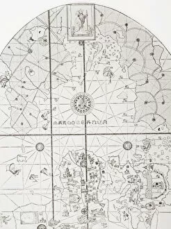
Background imageCartographer Collection: The sea chart of Juan de la Cosa. Juan de la Cosa, c. 1450 - 1510

The sea chart of Juan de la Cosa. Juan de la Cosa, c. 1450 - 1510. Spanish navigator and cartographer. Owner and captain of the Santa Maria

Background imageCartographer Collection: Leonardo di ser Piero da Vinci, 1452 - 1519, also known as Leonardo da Vinci or Leonardo

Leonardo di ser Piero da Vinci, 1452 - 1519, also known as Leonardo da Vinci or Leonardo. Italian Renaissance polymath: artist, sculptor, architect, musician, scientist, mathematician, engineer

Background imageCartographer Collection: Portrait Adriaan Reland professor Eastern languages

Portrait Adriaan Reland professor Eastern languages
Portrait of Adriaan Reland, Adriaan Reland, professor of Eastern languages, cartographer and Neo-Latin poet, at the age of 36. The print has a Latin signature

Background imageCartographer Collection: Portrait Christoffel Middaghten Schout-by-Nacht

Portrait Christoffel Middaghten Schout-by-Nacht
Portrait of Christoffel Middaghten, Schout-by-Nacht of the Frisian Admiralty and cartographer. In the background a sea battle, night, battle (sailing-ships), Christoffel Middaghten

Background imageCartographer Collection: Leonardo Di Ser Piero Da Vinci, 1452 A

Leonardo Di Ser Piero Da Vinci, 1452 A

Background imageCartographer Collection: William Martin Conway, 1St Baron Conway Of Allington, 1856

William Martin Conway, 1St Baron Conway Of Allington, 1856

Background imageCartographer Collection: Michael Servetus, Also Known As Miguel Servet Or Miguel Serveto, 1511

Michael Servetus, Also Known As Miguel Servet Or Miguel Serveto, 1511

Background imageCartographer Collection: Gerardus Mercator, 1512-1594. Flemish Cartographer. The Mercator Projection Is Named After Him

Gerardus Mercator, 1512-1594. Flemish Cartographer. The Mercator Projection Is Named After Him. From Crabbs Historical Dictionary Published 1825

Background imageCartographer Collection: Matthew Paris, C. 1200 To 1259. Benedictine Monk, English Chronicler

Matthew Paris, C. 1200 To 1259. Benedictine Monk, English Chronicler, Artist In Illuminated Manuscripts And Cartographer. From Crabbes Historical Dictionary Published 1825

Background imageCartographer Collection: John Speed, 1552 To 1629. English Historian And Cartographer

John Speed, 1552 To 1629. English Historian And Cartographer. From Crabbes Historical Dictionary Published 1825

Background imageCartographer Collection: Gemma Frisius Aka Reiner Gemma 1508 To 1555 Dutch Cartographer, Instrument Maker And Mathematician

Gemma Frisius Aka Reiner Gemma 1508 To 1555 Dutch Cartographer, Instrument Maker And Mathematician. From 18Th Century Woodcut

Background imageCartographer Collection: Amerigo Vespucci 1454 To 1512 Also Known As Americus Vespucius. Italian Explorer And Cartographer

Amerigo Vespucci 1454 To 1512 Also Known As Americus Vespucius. Italian Explorer And Cartographer. From An Early 19Th Century Engraving

Background imageCartographer Collection: Gerardus Mercator 1512 To 1594 Flemish Cartographer After A 19Th Century Illustration

Gerardus Mercator 1512 To 1594 Flemish Cartographer After A 19Th Century Illustration

Background imageCartographer Collection: Portolan of Joan Martines (16th century). 1587. Map of the C

Portolan of Joan Martines (16th century). 1587. Map of the C
Portolan of Spanish cartographer Joan Martines (16th century). Majorcal school. 1587. Map of the Canary Islands and the west coast of Africa. Messina, Sicily. National Library. Madrid. Spain

Background imageCartographer Collection: Juan de la Cosa (1460-1509)

Juan de la Cosa (1460-1509). Spanish navigator and cartographer. Portrait

Background imageCartographer Collection: Gerardus Mercator (1512-1594). Engraving

Gerardus Mercator (1512-1594). Engraving
Gerardus Mercator (1512-1594). Flemish cartographer. Engraving, 1595

Background imageCartographer Collection: Bucharest map

Bucharest map
Illustration of a Bucharest map

Background imageCartographer Collection: Map of old Italy

Map of old Italy
Vintage map of Italy

Background imageCartographer Collection: Antique map of asia in late 19th Century

Antique map of asia in late 19th Century
Vintage Antique map of asia in late 19th Century

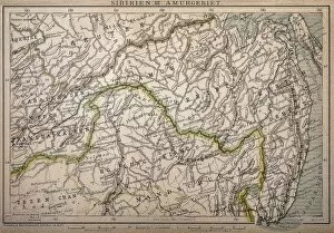
Background imageCartographer Collection: Siberia map, the Amur region

Siberia map, the Amur region
Illustration of a Siberia map, the Amur region

Background imageCartographer Collection: Belovar-koros, Croatio map from 1893

Belovar-koros, Croatio map from 1893
Antique illustration of a Belovar-koros, Croatio map from 1893

Background imageCartographer Collection: DUTCH COMMERCE, 1612. The Light of Navigation. Engraved frontispiece, 1612

DUTCH COMMERCE, 1612. The Light of Navigation. Engraved frontispiece, 1612, to a book of sea charts by the Dutch geographer Willem Janszoon Blaeu

Background imageCartographer Collection: Gerardus Mercator

Gerardus Mercator
GERARDUS MERCATOR Known also as Gerhard Kremer Flemish cartographer

Background imageCartographer Collection: James Cook 1728-1779. - Stich nach dem Gemalde von Dance, 1934

James Cook 1728-1779. - Stich nach dem Gemalde von Dance, 1934
James Cook 1728-1779, 1934. Captain James Cook FRS (1728-1779), British explorer, navigator, cartographer and captain in the Royal Navy. From Die Groszen der Weltgelchichte

Background imageCartographer Collection: Natives Gathered Round Them, c1908, (c1920). Artist: Joseph Ratcliffe Skelton

Natives Gathered Round Them, c1908, (c1920). Artist: Joseph Ratcliffe Skelton
Natives Gathered Round Them, c1908, (c1920). Captain Matthew Flinders (1774-1814), English navigator and cartographer, who was the first to circumnavigate Australia and identify it as a continent

Background imageCartographer Collection: Amerigo Vespucci, (1454-1512), 1912. Artist: Gaetano Grazzini

Amerigo Vespucci, (1454-1512), 1912. Artist: Gaetano Grazzini
Amerigo Vespucci (1454-1512), Italian explorer, financier, navigator and cartographer, 1912. Vespucci first demonstrated that Brazil

Background imageCartographer Collection: Petrus Plancius, Dutch astronomer, cartographer and clergyman, c1870. Artist: JH Rennefeld

Petrus Plancius, Dutch astronomer, cartographer and clergyman, c1870. Artist: JH Rennefeld
Petrus Plancius, Dutch astronomer, cartographer and clergyman, c1870. Plancius (1552-1622) was one of the founders of the Dutch East India Company, for whom he produced over a hundred maps

Background imageCartographer Collection: Robert Gordon of Straloch, Scottish cartographer, (1870). Artist:s Freeman

Robert Gordon of Straloch, Scottish cartographer, (1870). Artist:s Freeman
Robert Gordon of Straloch, Scottish cartographer, (1870). Gordon (1580-1661) is best known for his contributions to William Blaeus Great Atlas of Scotland

Background imageCartographer Collection: Reiner Gemma Frisius, Dutch astronomer, geographer, cartographer and mathematician, 1539

Reiner Gemma Frisius, Dutch astronomer, geographer, cartographer and mathematician, 1539. Gemma Frisius (1508-1555) holding an adjustable ring dial for determining the altitude of the Sun for

Background imageCartographer Collection: Peter Apian (1495-1552), German geographer, mathematician and astronomer

Peter Apian (1495-1552), German geographer, mathematician and astronomer. Apian established his reputation by issuing a world map in 1520, and the publication, in 1524

Background imageCartographer Collection: John Speed (1542-1629), English cartographer and historian, 1816

John Speed (1542-1629), English cartographer and historian, 1816. Speed is probably the most famous of British mapmakers. In 1612 he published The Theatre of the Empire of Great Britain

Background imageCartographer Collection: abraham ortelius, abrahami ortelii, antique, architecture, archival, atlas, biography

abraham ortelius, abrahami ortelii, antique, architecture, archival, atlas, biography, book, cartographer, cartography, cover, depicting, engraving, fancy, frontispiece, geography, historic, history


All Professionally Made to Order for Quick Shipping

"Unveiling the World: A Journey through the Eyes of Cartographers" Embark on a captivating voyage through time and space as we delve into the fascinating world of cartography. From the intrepid explorations of Captain James Cook in 1775 to Gerardus Mercator's groundbreaking map, Septentrionalium Terrarum descriptio, in 1595, these visionary individuals shaped our understanding of the globe. Traveling eastward, we encounter the Kingdom of Saxony's eastern part meticulously charted by skilled cartographers. The bustling ports of Portsmouth and Southampton come alive on Pinkerton Map's depiction of the British Isles in 1818, revealing their vital role in maritime history. Abraham Ortelius' magnum opus, Theatrum Orbis Terrarum (Theatre of the World), showcases an intricate tapestry that connects continents and cultures. Meanwhile, a glimpse at an old map from 1855 transports us to California's early days when its borders were still taking shape. A Vintage Map of the World invites us to explore distant lands like Bosnia, Dalmatia, Istria, Croatia, and Slavonia – regions steeped in rich history and cultural heritage. Leonard Euler's caricature adds a touch of whimsy to this journey as he playfully navigates his way across mathematical realms. As we turn back time once more with Sir Thomas More's Utopia woodcut from 1518 edition and Andreas Cellarius' masterful works capturing celestial wonders during Dutch-German Renaissance era; it becomes clear that cartography is not merely about maps but also about storytelling - weaving tales that transcend borders and eras. Join us as we celebrate these remarkable cartographers who dared to dream beyond horizons unknown – forever leaving their mark on our collective imagination. Let their artistry inspire you to see our world with fresh eyes while cherishing its ever-evolving beauty.