Fraud Blocker Skip to main content

Cartographer Collection (#3)

"Unveiling the World

Background imageCartographer Collection: 1818 Pinkerton Map Of The British Isles England

1818 Pinkerton Map Of The British Isles England
1818, Pinkerton Map of the British Isles, England, Scotland, Ireland, John Pinkerton, 1758 - 1826, Scottish antiquarian, cartographer, UK

Background imageCartographer Collection: 1818 Pinkerton Map Of Southwestern Germany Bavaria

1818 Pinkerton Map Of Southwestern Germany Bavaria
1818, Pinkerton Map of Southwestern Germany, Bavaria, Swabia, John Pinkerton, 1758 - 1826, Scottish antiquarian, cartographer, UK

Background imageCartographer Collection: 1818 Pinkerton Map Of Southern England Includes London

1818 Pinkerton Map Of Southern England Includes London
1818, Pinkerton Map of Southern England, includes London, John Pinkerton, 1758 - 1826, Scottish antiquarian, cartographer, UK

Background imageCartographer Collection: 1818 Pinkerton Map Of Southern Africa Congo Monomotapa

1818 Pinkerton Map Of Southern Africa Congo Monomotapa
1818, Pinkerton Map of Southern Africa, Congo, Monomotapa, Cape Colony, John Pinkerton, 1758 - 1826, Scottish antiquarian, cartographer, UK

Background imageCartographer Collection: 1818 Pinkerton Map Of Persia Iran Afghanistan

1818 Pinkerton Map Of Persia Iran Afghanistan
1818, Pinkerton Map of Persia, Iran, Afghanistan, John Pinkerton, 1758 - 1826, Scottish antiquarian, cartographer, UK

Background imageCartographer Collection: 1818 Pinkerton Map Of Of La Plata Southern South America

1818 Pinkerton Map Of Of La Plata Southern South America
1818, Pinkerton Map of of La Plata, Southern South America, Argentina, Chile, Bolivia, John Pinkerton, 1758 - 1826, Scottish antiquarian, cartographer, UK

Background imageCartographer Collection: 1818 Pinkerton Map Of Northeastern South America

1818 Pinkerton Map Of Northeastern South America
1818, Pinkerton Map of Northeastern South America, Venezuela, Guyana, Surinam, John Pinkerton, 1758 - 1826, Scottish antiquarian, cartographer, UK

Background imageCartographer Collection: 1818 Pinkerton Map Of India Pakistan Afghanistan

1818 Pinkerton Map Of India Pakistan Afghanistan
1818, Pinkerton Map of India, Pakistan, Afghanistan, Tibet, Nepal, Sri Lanka, John Pinkerton, 1758 - 1826, Scottish antiquarian, cartographer, UK

Background imageCartographer Collection: 1811 Pinkerton Map Of Persia Iraq Iran Afghanistan

1811 Pinkerton Map Of Persia Iraq Iran Afghanistan
1811, Pinkerton Map of Persia, Iraq, Iran, Afghanistan, John Pinkerton, 1758 - 1826, Scottish antiquarian, cartographer, UK

Background imageCartographer Collection: 1818 Pinkerton Map Of Nubia Sudan And Abyssinia

1818 Pinkerton Map Of Nubia Sudan And Abyssinia
1818, Pinkerton Map of Nubia, Sudan and Abyssinia, John Pinkerton, 1758 - 1826, Scottish antiquarian, cartographer, UK

Background imageCartographer Collection: 1818 Pinkerton Map Of Northwestern South America

1818 Pinkerton Map Of Northwestern South America
1818, Pinkerton Map of Northwestern South America, Columbia, Venezuela, Ecuador, Panama, John Pinkerton, 1758 - 1826, Scottish antiquarian, cartographer, UK

Background imageCartographer Collection: 1818 Pinkerton Map Of Jersey Guernsey Scilly And Shetland

1818 Pinkerton Map Of Jersey Guernsey Scilly And Shetland
1818, Pinkerton Map of Jersey, Guernsey, Scilly and Shetland, British Isles, John Pinkerton, 1758 - 1826, Scottish antiquarian, cartographer, UK

Background imageCartographer Collection: 1818 Pinkerton Map Of China With Taiwan Or Formosa

1818 Pinkerton Map Of China With Taiwan Or Formosa
1818, Pinkerton Map of China, with Taiwan or Formosa, John Pinkerton, 1758 - 1826, Scottish antiquarian, cartographer, UK

Background imageCartographer Collection: 1818 Pinkerton Map Of Australia And New Zealand

1818 Pinkerton Map Of Australia And New Zealand
1818, Pinkerton Map of Australia and New Zealand, John Pinkerton, 1758 - 1826, Scottish antiquarian, cartographer, UK

Background imageCartographer Collection: 1818 Pinkerton Map Of Abyssinia Ethiopia Sudan And Nubia

1818 Pinkerton Map Of Abyssinia Ethiopia Sudan And Nubia
1818, Pinkerton Map of Abyssinia, Ethiopia, Sudan and Nubia, John Pinkerton, 1758 - 1826, Scottish antiquarian, cartographer, UK

Background imageCartographer Collection: 1818 Pinkerton Map Of Northern Italy Tuscany

1818 Pinkerton Map Of Northern Italy Tuscany
1818, Pinkerton Map of Northern Italy, Tuscany, Piedmont, Milan, Venice, John Pinkerton, 1758 - 1826, Scottish antiquarian, cartographer, UK

Background imageCartographer Collection: 1813 Pinkerton Map Of Western Africa Niger Valley

1813 Pinkerton Map Of Western Africa Niger Valley
1813, Pinkerton Map of Western Africa, Niger Valley, Mountains of Kong, John Pinkerton, 1758 - 1826, Scottish antiquarian, cartographer, UK

Background imageCartographer Collection: 1809 Pinkerton Map Of Northern Italy Tuscany

1809 Pinkerton Map Of Northern Italy Tuscany
1809, Pinkerton Map of Northern Italy, Tuscany, Florence, Venice, Milan, John Pinkerton, 1758 - 1826, Scottish antiquarian, cartographer, UK

Background imageCartographer Collection: 1809 Pinkerton Map Of Korea And Japan John Pinkerton

1809 Pinkerton Map Of Korea And Japan John Pinkerton
1809, Pinkerton Map of Korea and Japan, John Pinkerton, 1758 - 1826, Scottish antiquarian, cartographer, UK

Background imageCartographer Collection: Sir Robert Dudley, Duke of Northumberland, c1600. Creator: Nicholas Hilliard

Sir Robert Dudley, Duke of Northumberland, c1600. Creator: Nicholas Hilliard
Sir Robert Dudley, Duke of Northumberland, c1600

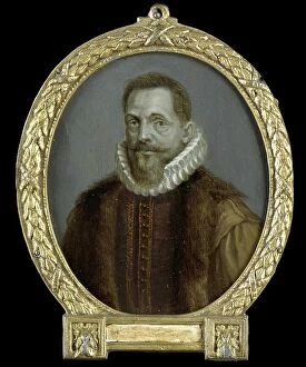
Background imageCartographer Collection: Portrait of Petrus Bertius, Professor at Leiden, 1700-1732. Creator: Arnoud van Halen

Portrait of Petrus Bertius, Professor at Leiden, 1700-1732. Creator: Arnoud van Halen
Portrait of Petrus Bertius, Professor at Leiden, 1700-1732

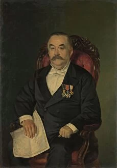
Background imageCartographer Collection: Johan François Adriaan Cateau van Rosevelt... 1885. Creator: Lovera

Johan François Adriaan Cateau van Rosevelt... 1885. Creator: Lovera
Johan Francois Adriaan Cateau van Rosevelt, Chief of the Construction Department and Agent General of Immigration in Suriname, 1885

Background imageCartographer Collection: The Art Gallery of Jan Gildemeester Jansz, 1794-1795. Creator: Adriaan De Lelie

The Art Gallery of Jan Gildemeester Jansz, 1794-1795. Creator: Adriaan De Lelie
The Art Gallery of Jan Gildemeester Jansz, 1794-1795. In 1792, Gildemeester, a merchant, turned two large rooms at his house on Amsterdam's Herengracht into an art gallery

Background imageCartographer Collection: Geological Survey art room, between 1910 and 1920. Creator: Harris & Ewing

Geological Survey art room, between 1910 and 1920. Creator: Harris & Ewing
Geological Survey art room, [Washington, DC], between 1910 and 1920. [Map-making]

Background imageCartographer Collection: Portrait of Girolamo Ruscelli, 1566. Creator: Nicolo Nelli

Portrait of Girolamo Ruscelli, 1566. Creator: Nicolo Nelli
Portrait of Girolamo Ruscelli, 1566

Background imageCartographer Collection: Map of California shown as an island, c 1650. Creator: Johannes Vingboons

Map of California shown as an island, c 1650. Creator: Johannes Vingboons
Map of California shown as an island, c 1650. This map from around 1650 shows California as an island. A half-century would pass before Spanish explorers determined with certainty that California was

Background imageCartographer Collection: Carte re´duite des de´couvertes des Russes, entre l'Asie et l'Amerique, (1747?)

Carte re´duite des de´couvertes des Russes, entre l'Asie et l'Amerique, (1747?). This French map of Alaska, Siberia, and the North Pacific, published in 1747

Background imageCartographer Collection: General Map of Ekaterinoslav Province: Showing Postal and Major Roads, Stations and the... 1821

General Map of Ekaterinoslav Province: Showing Postal and Major Roads, Stations and the... 1821
General Map of Ekaterinoslav Province: Showing Postal and Major Roads, Stations and the Distance in Versts between Them, 1821

Background imageCartographer Collection: General Map of Kharkiv Province: Showing Postal and Major Roads, Stations and the... 1821

General Map of Kharkiv Province: Showing Postal and Major Roads, Stations and the... 1821
General Map of Kharkiv Province: Showing Postal and Major Roads, Stations and the Distance in Versts between Them, 1821. This 1821 map of Kharkiv Provinceis from a larger work

Background imageCartographer Collection: General Map of Tver Province: Showing Postal and Major Roads, Stations and the... 1821

General Map of Tver Province: Showing Postal and Major Roads, Stations and the... 1821
General Map of Tver Province: Showing Postal and Major Roads, Stations and the Distance in Versts between Them, 1821. This 1821 map of Tver Provinceis from a larger work

Background imageCartographer Collection: General Map of Novgorod Province: Showing Postal and Major Roads, Stations and the... 1821

General Map of Novgorod Province: Showing Postal and Major Roads, Stations and the... 1821
General Map of Novgorod Province: Showing Postal and Major Roads, Stations and the Distance in Versts between Them, 1821. This 1821 map of Novgorod Provinceis from a larger work

Background imageCartographer Collection: General Map of Bessarabia: Showing Postal and Major Roads, Stations and the... 1821

General Map of Bessarabia: Showing Postal and Major Roads, Stations and the... 1821
General Map of Bessarabia: Showing Postal and Major Roads, Stations and the Distance in Versts between Them, 1821. This 1821 map of Bessarabia is from a larger work

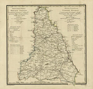
Background imageCartographer Collection: General Map of Minsk Province: Showing Postal and Major Roads, Stations and the... 1821

General Map of Minsk Province: Showing Postal and Major Roads, Stations and the... 1821
General Map of Minsk Province: Showing Postal and Major Roads, Stations and the Distance in Versts between Them, 1821. This 1821 map of Minsk Province is from a larger work

Background imageCartographer Collection: General Map of Vitebsk Province: Showing Postal and Major Roads, Stations and the... 1820

General Map of Vitebsk Province: Showing Postal and Major Roads, Stations and the... 1820
General Map of Vitebsk Province: Showing Postal and Major Roads, Stations and the Distance in Versts between Them, 1820. This 1820 map of Vitebsk Provinceis from a larger work

Background imageCartographer Collection: General Map of Saint Petersburg Province: Showing Postal and Major Roads, Stations and the... 1820

General Map of Saint Petersburg Province: Showing Postal and Major Roads, Stations and the... 1820
General Map of Saint Petersburg Province: Showing Postal and Major Roads, Stations and the Distance in Versts between Them, 1820

Background imageCartographer Collection: General Map of Livland Province: Showing Postal and Major Roads, Stations and the... 1820

General Map of Livland Province: Showing Postal and Major Roads, Stations and the... 1820
General Map of Livland Province: Showing Postal and Major Roads, Stations and the Distance in Versts between Them, 1820. This 1820 map of Livland Provinceis from a larger work

Background imageCartographer Collection: General Map of Courland Province: Showing Postal and Major Roads, Stations and the... 1820

General Map of Courland Province: Showing Postal and Major Roads, Stations and the... 1820
General Map of Courland Province: Showing Postal and Major Roads, Stations and the Distance in Versts between Them, 1820. This 1820 map of Courland Province is from a larger work

Background imageCartographer Collection: General Map of Vilnius Province: Showing Postal and Major Roads, Stations and the... 1820

General Map of Vilnius Province: Showing Postal and Major Roads, Stations and the... 1820
General Map of Vilnius Province: Showing Postal and Major Roads, Stations and the Distance in Versts between Them, 1820. This 1820 map of Vilnius Provinceis from a larger work

Background imageCartographer Collection: WW1 - Battle of Cateau 1914

WW1 - Battle of Cateau 1914
3789968 WW1 - Battle of Cateau 1914; (add.info.: Battle of Cateau. Map shows the retreat of the British at Cateau, with calvary led by General Allenby)

Background imageCartographer Collection: Jedediah Smith (1799-1831) being attacked by a Grizzly bear, c. 1861 (colour litho)

Jedediah Smith (1799-1831) being attacked by a Grizzly bear, c. 1861 (colour litho)
PNP245844 Jedediah Smith (1799-1831) being attacked by a Grizzly bear, c.1861 (colour litho) by American School, (19th century); Private Collection; (add.info.: Jedediah Strong Smith (January 6)

Background imageCartographer Collection: Mercator, (1512-1594), 1830. Creator: Unknown

Mercator, (1512-1594), 1830. Creator: Unknown
Mercator, (1512-1594), 1830. Gerardus Mercator (1512-1594) Belgian geographer, cosmographer and cartographer known for his 1569 world map of sailing courses with rhumb lines

Background imageCartographer Collection: na

na
Paul Sandby, 1731 - 1809. English cartographer and landscape painter. Founding member of the Royal Academy. From a print by Burnet Reading from the painting by Peter Falconet

Background imageCartographer Collection: Map of the world, based on descriptions and co-ordinates given in Geographia

Map of the world, based on descriptions and co-ordinates given in Geographia
BAL42850 Map of the world, based on descriptions and co-ordinates given in Geographia, by Ptolemy (Claudius Ptolemaeus of Alexandria) (c.90-168 AD); O'Shea Gallery, London, UK

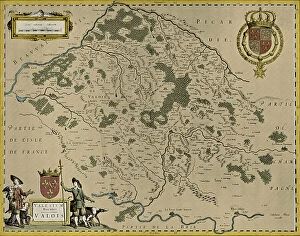
Background imageCartographer Collection: Map of Valois, 1926 (print)

Map of Valois, 1926 (print)
3786712 Map of Valois, 1926 (print) by Blaeu, Willem (1571-1638) and Joan (1596-1673); Private Collection; (add.info.: by Willem and Joan Blaeu)

Background imageCartographer Collection: C B Wadstrom - Cartographer

C B Wadstrom - Cartographer

Background imageCartographer Collection: Roger Joseph Boscovich - Cartographer

Roger Joseph Boscovich - Cartographer

Background imageCartographer Collection: Nicolas De Fer - Cartographer

Nicolas De Fer - Cartographer

Background imageCartographer Collection: Carl Ludewig Von Oesfeld - Cartographer

Carl Ludewig Von Oesfeld - Cartographer


All Professionally Made to Order for Quick Shipping

"Unveiling the World: A Journey through the Eyes of Cartographers" Embark on a captivating voyage through time and space as we delve into the fascinating world of cartography. From the intrepid explorations of Captain James Cook in 1775 to Gerardus Mercator's groundbreaking map, Septentrionalium Terrarum descriptio, in 1595, these visionary individuals shaped our understanding of the globe. Traveling eastward, we encounter the Kingdom of Saxony's eastern part meticulously charted by skilled cartographers. The bustling ports of Portsmouth and Southampton come alive on Pinkerton Map's depiction of the British Isles in 1818, revealing their vital role in maritime history. Abraham Ortelius' magnum opus, Theatrum Orbis Terrarum (Theatre of the World), showcases an intricate tapestry that connects continents and cultures. Meanwhile, a glimpse at an old map from 1855 transports us to California's early days when its borders were still taking shape. A Vintage Map of the World invites us to explore distant lands like Bosnia, Dalmatia, Istria, Croatia, and Slavonia – regions steeped in rich history and cultural heritage. Leonard Euler's caricature adds a touch of whimsy to this journey as he playfully navigates his way across mathematical realms. As we turn back time once more with Sir Thomas More's Utopia woodcut from 1518 edition and Andreas Cellarius' masterful works capturing celestial wonders during Dutch-German Renaissance era; it becomes clear that cartography is not merely about maps but also about storytelling - weaving tales that transcend borders and eras. Join us as we celebrate these remarkable cartographers who dared to dream beyond horizons unknown – forever leaving their mark on our collective imagination. Let their artistry inspire you to see our world with fresh eyes while cherishing its ever-evolving beauty.