Fraud Blocker Skip to main content

Cartographer Collection (#4)

"Unveiling the World

Background imageCartographer Collection: Alex Hub Jaillot - Cartographer

Alex Hub Jaillot - Cartographer

Background imageCartographer Collection: Ios Nicolas De L'Isle - Astronomer and Cartographer

Ios Nicolas De L'Isle - Astronomer and Cartographer

Background imageCartographer Collection: D Christoval Colon - Cartographer

D Christoval Colon - Cartographer

Background imageCartographer Collection: Ioh Bapt Tavernier - Cartographer

Ioh Bapt Tavernier - Cartographer

Background imageCartographer Collection: Ioh Gabr Doppelmeyer - Cartographer

Ioh Gabr Doppelmeyer - Cartographer

Background imageCartographer Collection: Cesar Francois Cassini De Thury - Cartographer

Cesar Francois Cassini De Thury - Cartographer

Background imageCartographer Collection: Vincent Coronelli - Cartographer

Vincent Coronelli - Cartographer

Background imageCartographer Collection: Gerhard Mercator - Cartographer

Gerhard Mercator - Cartographer

Background imageCartographer Collection: Philipp Cluver - Cartographer

Philipp Cluver - Cartographer

Background imageCartographer Collection: Ioh Bapt Homann - Cartographer

Ioh Bapt Homann - Cartographer

Background imageCartographer Collection: Hugo Linschoten - Cartographer

Hugo Linschoten - Cartographer

Background imageCartographer Collection: Jean Domin Cassini - Cartographer

Jean Domin Cassini - Cartographer

Background imageCartographer Collection: Conrad Peutinger - Cartographer

Conrad Peutinger - Cartographer

Background imageCartographer Collection: Ios Nicolas De L'Isle - Cartographer

Ios Nicolas De L'Isle - Cartographer

Background imageCartographer Collection: Captain James Cook - portrait

Captain James Cook - portrait
3785202 Captain James Cook - portrait; (add.info.: Captain James Cook - portrait after N. Dance. English explorer, navigator and cartographer)

Background imageCartographer Collection: Captain James Cook - portrait

Captain James Cook - portrait
3784445 Captain James Cook - portrait; (add.info.: Captain James Cook - portrait after N. Dance. English explorer, navigator and cartographer)

Background imageCartographer Collection: Sketch depicting jointed wings by Leonardo da Vinci, 16th century (drawing)

Sketch depicting jointed wings by Leonardo da Vinci, 16th century (drawing)
5308072 Sketch depicting jointed wings by Leonardo da Vinci, 16th century (drawing) by Vinci, Leonardo da (1452-1519); Universal History Archive/UIG

Background imageCartographer Collection: map of Delft, Netherlands, 1617 (engraving)

map of Delft, Netherlands, 1617 (engraving)
3918326 map of Delft, Netherlands, 1617 (engraving) by Braun, Georg (1541-1622); (add.info.: Delft, Netherlands - in Civitates Orbis Terrarum by Georg Braun)

Background imageCartographer Collection: Captain Richard Francis Burton - portrait standing, 1885

Captain Richard Francis Burton - portrait standing, 1885
3919256 Captain Richard Francis Burton - portrait standing, 1885 by Pellegrini, Carlo ('Ape') (1839-89); (add.info.: Captain Richard Francis Burton - portrait standing)

Background imageCartographer Collection: Mercator and Ortelius (oil on canvas)

Mercator and Ortelius (oil on canvas)
471368 Mercator and Ortelius (oil on canvas) by Bellemans, Jozef (Joseph) (1816-88); 175x144 cm; Koninklijk Museum voor Schone Kunsten, Antwerp

Background imageCartographer Collection: World Map, 1695 (engraving)

World Map, 1695 (engraving)
3918526 World Map, 1695 (engraving) by Jaillot, Alexis-Hubert (1632-1712); (add.info.: Map of World - by A.H. Jaillot in Atlas Francais - Paris, 1695); Photo © Luigino Visconti

Background imageCartographer Collection: World Map, 1695 (engraving)

World Map, 1695 (engraving)
3918656 World Map, 1695 (engraving) by Jaillot, Alexis-Hubert (1632-1712); (add.info.: World Maps - by A.H. Jaillot in Atlas Francais - Paris, 1695); Photo © Luigino Visconti

Background imageCartographer Collection: North of World, 1695 (engraving)

North of World, 1695 (engraving)
3918529 North of World, 1695 (engraving) by Jaillot, Alexis-Hubert (1632-1712); (add.info.: North of World -by A.H. Jaillot in Atlas Francais - Paris, 1695); Photo © Luigino Visconti

Background imageCartographer Collection: Leonardo di ser Piero da Vinci, from Living Biographies of Great Painters

Leonardo di ser Piero da Vinci, from Living Biographies of Great Painters
3960932 Leonardo di ser Piero da Vinci, from Living Biographies of Great Painters by Ross, Gordon (1872-1946); (add.info.: Leonardo di ser Piero da Vinci, 1452-1519)

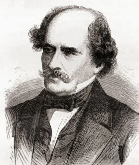
Background imageCartographer Collection: Portrait of Arthur Carl Victor Schott (1814-1875), Before 1875. Creator: Unknown

Portrait of Arthur Carl Victor Schott (1814-1875), Before 1875. Creator: Unknown
Portrait of Arthur Carl Victor Schott (1814-1875), Before 1875

Background imageCartographer Collection: Portrait of Increase Allen Lapham (1811-1875) - Examining the Wisconsin Meteorite

Portrait of Increase Allen Lapham (1811-1875) - Examining the Wisconsin Meteorite, Circa 1868

Background imageCartographer Collection: Portrait of William Henry Holmes, 1890s. Creator: United States National Museum

Portrait of William Henry Holmes, 1890s. Creator: United States National Museum
Portrait of William Henry Holmes, 1890s

Background imageCartographer Collection: View of Rio de Janeiro, Brazil, 1600 (coloured engraving)

View of Rio de Janeiro, Brazil, 1600 (coloured engraving)
GIA3051063 View of Rio de Janeiro, Brazil, 1600 (coloured engraving) by Blaeu, Willem (1571-1638); Biblioteca Angelica, Rome, Italy; eGiancarlo Costa; Dutch, out of copyright

Background imageCartographer Collection: View of Turin, 1672 (engraving)

View of Turin, 1672 (engraving)
1195490 View of Turin, 1672 (engraving) by Borgonio, Giovanni Tommaso (1620-1683); 50x109.5 cm; Private Collection; (add.info.: Borgonio)

Background imageCartographer Collection: The Holy Land, c. 1770 (hand-coloured engraving)

The Holy Land, c. 1770 (hand-coloured engraving)
986326 The Holy Land, c.1770 (hand-coloured engraving) by French School, (18th century); 97x123 cm; Private Collection; (add.info.: The Holy Land... divided into its twelve tribes; La Terre Sainte)

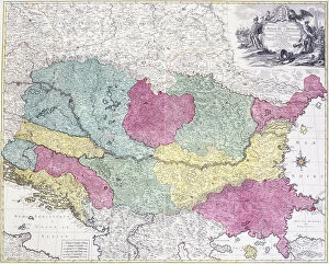
Background imageCartographer Collection: Geographical Map of the Theatre of War, showing the Kingdom of Hungary in the main

Geographical Map of the Theatre of War, showing the Kingdom of Hungary in the main
986323 Geographical Map of the Theatre of War, showing the Kingdom of Hungary in the main, 1771 (hand-coloured engraving.) by German School

Background imageCartographer Collection: Map, illustration from The Liber Insularum Archipelagi (vellum)

Map, illustration from The Liber Insularum Archipelagi (vellum)
480612 Map, illustration from The Liber Insularum Archipelagi (vellum) by Buondelmonti, Cristoforo (1385-1430); 25.4x16.4 cm; Private Collection; (add.info)

Background imageCartographer Collection: Gerardus Mercator, Flemish cartographer, geographer and cosmographer (engraving)

Gerardus Mercator, Flemish cartographer, geographer and cosmographer (engraving)
3646701 Gerardus Mercator, Flemish cartographer, geographer and cosmographer (engraving) by Hogenberg, Franz (1540-c.1590) (after); Private Collection; (add.info.: Gerardus Mercator (1512-1594)

Background imageCartographer Collection: World map of the Arab geographer and cartographer Muhammad al-Idrisi, 1150 (engraving)

World map of the Arab geographer and cartographer Muhammad al-Idrisi, 1150 (engraving)
3647375 World map of the Arab geographer and cartographer Muhammad al-Idrisi, 1150 (engraving) by German School, (19th century); Private Collection; (add.info)

Background imageCartographer Collection: Adolphe Quetelet, Belgian mathematician, astronomer and statistician

Adolphe Quetelet, Belgian mathematician, astronomer and statistician
3614729 Adolphe Quetelet, Belgian mathematician, astronomer and statistician by Demannez, Joseph-Arnold (1825-1902); Private Collection; (add.info)

Background imageCartographer Collection: Captain Cook approaching New Zealand, illustration from Hutchinson

Captain Cook approaching New Zealand, illustration from Hutchinson
STC373559 Captain Cook approaching New Zealand, illustration from Hutchinsons Story of the British Nation, c.1923 (litho) by Woodville

Background imageCartographer Collection: Amerigo Vespucci, Italian navigator (chromolitho)

Amerigo Vespucci, Italian navigator (chromolitho)
972234 Amerigo Vespucci, Italian navigator (chromolitho) by French School, (19th century); Private Collection; (add.info.: Amerigo Vespucci (1454-1512), Italian navigator and cartographer

Background imageCartographer Collection: Captain Burton, illustration from The Pictorial Edition of the Life

Captain Burton, illustration from The Pictorial Edition of the Life
STC418106 Captain Burton, illustration from The Pictorial Edition of the Life and Discoveries of David Livingstone by J. Ewing Richie, pub. by A. Fullarton & Co

Background imageCartographer Collection: Amerigo Vespucci, in the Sala del Mappamondo (fresco)

Amerigo Vespucci, in the Sala del Mappamondo (fresco)
808745 Amerigo Vespucci, in the Sala del Mappamondo (fresco) by Italian School, (16th century); Villa Farnese, Caprarola, Voterbo, Lazio

Background imageCartographer Collection: Matthew Fontaine Maury, from Les Merveilles de la Science, published c. 1870 (engraving)

Matthew Fontaine Maury, from Les Merveilles de la Science, published c. 1870 (engraving)
2619105 Matthew Fontaine Maury, from Les Merveilles de la Science, published c.1870 (engraving) by French School, (19th century); Private Collection; (add.info.: Matthew Fontaine Maury (1806-73)

Background imageCartographer Collection: Part of the London Wall in the churchyard of St. Giles

Part of the London Wall in the churchyard of St. Giles
Part of the ancient London Wall in the churchyard of St. Giles, Cripplegate, London. Built in the third century, and repaired by London Mayor Ralph Joceline in 1477

Background imageCartographer Collection: An Argument Between Cartographers, illustration from Book 2 Part 5 Chapter 10 of

An Argument Between Cartographers, illustration from Book 2 Part 5 Chapter 10 of
STC134237 An Argument Between Cartographers, illustration from Book 2 Part 5 Chapter 10 of The Principles of Philosophy, engraved by Johannes Kip (1653/53-1722), 1694 (engraving) by Freman, G (fl)

Background imageCartographer Collection: Map of Virginia, discovered and described by Captain John Smith, 1606

Map of Virginia, discovered and described by Captain John Smith, 1606
STC174211 Map of Virginia, discovered and described by Captain John Smith, 1606, engraved by William Hole (fl. 1607-24), published 1612 (engraving) (see also 174212) by Smith

Background imageCartographer Collection: Map of the Bay of Darien, 1709-13 (colour litho)

Map of the Bay of Darien, 1709-13 (colour litho)
VEN1126513 Map of the Bay of Darien, 1709-13 (colour litho) by Keulen, Gerard van (1678-1726); Biblioteca Angelica, Rome, Italy; (add.info)

Background imageCartographer Collection: Map of the Bay of Rio de Janeiro, 1709-13 (colour litho)

Map of the Bay of Rio de Janeiro, 1709-13 (colour litho)
VEN3051065 Map of the Bay of Rio de Janeiro, 1709-13 (colour litho) by Keulen, Gerard van (1678-1726); Biblioteca Angelica, Rome, Italy; Photo eMarco Ravenna; Dutch, out of copyright

Background imageCartographer Collection: Gloucester(shire), 1579 (hand-coloured engraving)

Gloucester(shire), 1579 (hand-coloured engraving)
985997 Gloucester(shire), 1579 (hand-coloured engraving) by Saxton, Christopher (c.1542-c.1610); 41.5x55 cm; Private Collection; (add.info.: Gloucester(shire); Glocestriae

Background imageCartographer Collection: Map of India and Southeastern Asia; Il Disegno Della Terza Parte Dell Asia

Map of India and Southeastern Asia; Il Disegno Della Terza Parte Dell Asia
1195417 Map of India and Southeastern Asia; Il Disegno Della Terza Parte Dell Asia, 1561 (engraving) by Gastaldi, Giacomo (c.1500-66) (after); 48x73, 2 cm; Private Collection; (add.info.: Gastaldi)


All Professionally Made to Order for Quick Shipping

"Unveiling the World: A Journey through the Eyes of Cartographers" Embark on a captivating voyage through time and space as we delve into the fascinating world of cartography. From the intrepid explorations of Captain James Cook in 1775 to Gerardus Mercator's groundbreaking map, Septentrionalium Terrarum descriptio, in 1595, these visionary individuals shaped our understanding of the globe. Traveling eastward, we encounter the Kingdom of Saxony's eastern part meticulously charted by skilled cartographers. The bustling ports of Portsmouth and Southampton come alive on Pinkerton Map's depiction of the British Isles in 1818, revealing their vital role in maritime history. Abraham Ortelius' magnum opus, Theatrum Orbis Terrarum (Theatre of the World), showcases an intricate tapestry that connects continents and cultures. Meanwhile, a glimpse at an old map from 1855 transports us to California's early days when its borders were still taking shape. A Vintage Map of the World invites us to explore distant lands like Bosnia, Dalmatia, Istria, Croatia, and Slavonia – regions steeped in rich history and cultural heritage. Leonard Euler's caricature adds a touch of whimsy to this journey as he playfully navigates his way across mathematical realms. As we turn back time once more with Sir Thomas More's Utopia woodcut from 1518 edition and Andreas Cellarius' masterful works capturing celestial wonders during Dutch-German Renaissance era; it becomes clear that cartography is not merely about maps but also about storytelling - weaving tales that transcend borders and eras. Join us as we celebrate these remarkable cartographers who dared to dream beyond horizons unknown – forever leaving their mark on our collective imagination. Let their artistry inspire you to see our world with fresh eyes while cherishing its ever-evolving beauty.