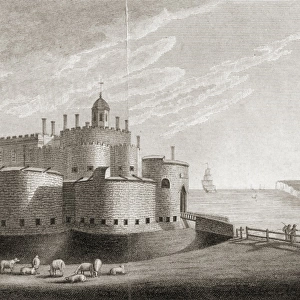
Jigsaw Puzzle > Europe > United Kingdom > England > Kent > Sandgate
Jigsaw Puzzle : Kent coastal defences in 1740 J010166


![]()
Jigsaw Puzzles from Historic England
Kent coastal defences in 1740 J010166
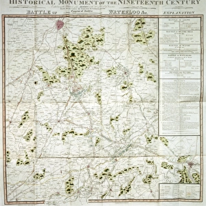
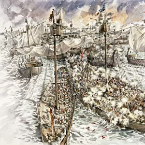
WALMER CASTLE, Kent. " Plan of the coast of Kent from Ramsgate to Rye" 1740. Chart of the approaches to the Kent coast showing details of the coastal defences at Sandwich, Deal, Dover, Walmer and Sandgate. Map
Historic England is the public body that champions and protects England's historic places
Media ID 5240362
© Historic England
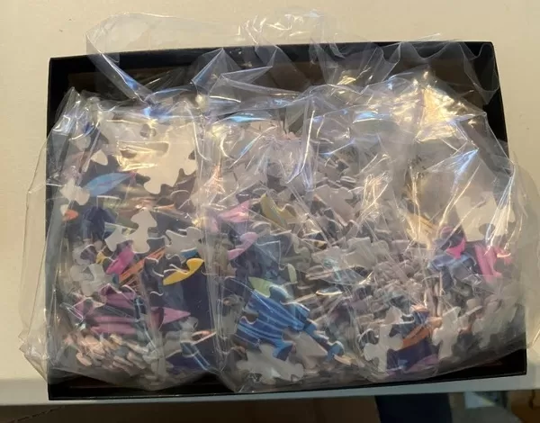
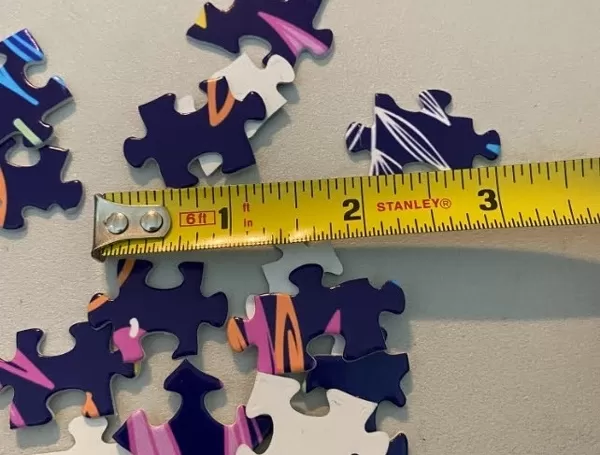
Jigsaw Puzzle (1014 Pieces)
Discover the rich history of Kent's coastal defenses with our captivating jigsaw puzzle from Media Storehouse. This intricately detailed puzzle features an antique chart from Historic England Photo Library, dating back to 1740. Depicting the approaches to the Kent coast, the puzzle showcases the defensive structures at Sandwich, Deal, and Dover. Immerse yourself in the past as you piece together this historical jigsaw puzzle, perfect for history enthusiasts and puzzle lovers alike.
Made in the USA, 1014-piece puzzles measure 20" x 30" (50.8 x 76.2 cm). Every puzzle is meticulously printed on glossy photo paper, which has a strong 1.33 mm thickness. Delivered in a black storage cardboard box, these puzzles are both stylish and practical. (Note: puzzles contain small parts and are not suitable for children under 3 years of age.)
Jigsaw Puzzles are an ideal gift for any occasion
Estimated Product Size is 76cm x 50.8cm (29.9" x 20")
These are individually made so all sizes are approximate
Artwork printed orientated as per the preview above, with landscape (horizontal) orientation to match the source image.
FEATURES IN THESE COLLECTIONS
> Historic England
> England at War
> Defending the Coast
> Historic England
> Heritage
> Objects and Artefacts
> Animals
> Birds
> Columbiformes
> Doves
> Related Images
> Asia
> Georgia
> Related Images
> Europe
> United Kingdom
> England
> Castles
> Europe
> United Kingdom
> England
> Kent
> Deal
> Europe
> United Kingdom
> England
> Kent
> Dover
> Europe
> United Kingdom
> England
> Kent
> Ramsgate
> Europe
> United Kingdom
> England
> Kent
> Related Images
> Europe
> United Kingdom
> England
> Kent
> Sandgate
> Europe
> United Kingdom
> England
> Kent
> Sandwich
EDITORS COMMENTS
This print takes us back to the year 1740, offering a glimpse into the coastal defences of Kent during the Georgian era. Titled "Kent Coastal Defences in 1740 J010166" this historic artifact showcases a meticulously detailed plan of the coast from Ramsgate to Rye. The chart provides invaluable insights into the strategic locations and intricate fortifications that safeguarded Sandwich, Deal, Dover, Walmer, and Sandgate. As we delve into this snapshot from history, we are transported to an era where protection against potential invasions was paramount. The map reveals an array of defensive structures dotting the coastline - bastions standing tall like sentinels guarding their territories. Each stronghold is carefully marked with precision on this remarkable document. The image emanates a sense of awe as we contemplate how these coastal defences played a crucial role in safeguarding Kent's shores centuries ago. It serves as a testament to human ingenuity and determination in protecting their land from external threats. Preserved by Historic England Photo Library, this print not only captures our attention but also invites us to reflect upon our rich heritage and appreciate those who came before us. It reminds us that history is not merely confined within textbooks; it lives through artifacts like these – windows into forgotten worlds waiting for curious minds to explore them once again.
MADE IN THE USA
Safe Shipping with 30 Day Money Back Guarantee
FREE PERSONALISATION*
We are proud to offer a range of customisation features including Personalised Captions, Color Filters and Picture Zoom Tools
SECURE PAYMENTS
We happily accept a wide range of payment options so you can pay for the things you need in the way that is most convenient for you
* Options may vary by product and licensing agreement. Zoomed Pictures can be adjusted in the Cart.