Fraud Blocker Skip to main content

Home > Europe > Republic of Ireland > Maps

Maps Collection (#9)

The Republic of Ireland is located in the North Atlantic Ocean and is part of Europe

1,481 Items

Background imageMaps Collection: The Abbot's Courtyard, Westminster Abbey (b/w photo)

The Abbot's Courtyard, Westminster Abbey (b/w photo)
8648780 The Abbot's Courtyard, Westminster Abbey (b/w photo) by English Photographer, (20th century); Private Collection; (add.info.: The Abbot's Courtyard, Westminster Abbey)

Background imageMaps Collection: Plan of Westminster and West Central London (b/w photo)

Plan of Westminster and West Central London (b/w photo)
8648775 Plan of Westminster and West Central London (b/w photo) by English Photographer, (20th century); Private Collection; (add.info.: Plan of Westminster and West Central London)

Background imageMaps Collection: Another prize-winning window (b/w photo)

Another prize-winning window (b/w photo)
8647475 Another prize-winning window (b/w photo) by English Photographer, (20th century); Private Collection; (add.info.: Another prize-winning window)

Background imageMaps Collection: Map of Atholl and Breadalbane (b/w photo)

Map of Atholl and Breadalbane (b/w photo)
8648711 Map of Atholl and Breadalbane (b/w photo) by English Photographer, (20th century); Private Collection; (add.info.: Map of Atholl and Breadalbane)

Background imageMaps Collection: Central Europe at the height of Napoleon's Power, 1812 (colour litho)

Central Europe at the height of Napoleon's Power, 1812 (colour litho)
8652270 Central Europe at the height of Napoleon's Power, 1812 (colour litho) by English School, (19th century); Private Collection; (add.info.: Central Europe at the height of Napoleon's Power)

Background imageMaps Collection: British Isles, Economic, Leading Industries (litho)

British Isles, Economic, Leading Industries (litho)
8652551 British Isles, Economic, Leading Industries (litho) by Bartholomew, John George (1860-1920) ; Private Collection; (add.info.: British Isles, Economic, Leading Industries)

Background imageMaps Collection: Map of the Yarrow and Ettrick Valleys (b/w photo)

Map of the Yarrow and Ettrick Valleys (b/w photo)
8651357 Map of the Yarrow and Ettrick Valleys (b/w photo) by English Photographer, (20th century); Private Collection; (add.info.: Map of the Yarrow and Ettrick Valleys)

Background imageMaps Collection: Plan of Dublin (b/w photo)

Plan of Dublin (b/w photo)
8651346 Plan of Dublin (b/w photo) by English Photographer, (20th century); Private Collection; (add.info.: Plan of Dublin)

Background imageMaps Collection: Hastings, Battle of Senlac, 14 October 1066 (litho)

Hastings, Battle of Senlac, 14 October 1066 (litho)
8652539 Hastings, Battle of Senlac, 14 October 1066 (litho) by Bartholomew, John George (1860-1920) ; Private Collection; (add.info.: Hastings, Battle of Senlac, 14 October 1066)

Background imageMaps Collection: Route of the Canterbury Pilgrims from London to Canterbury (litho)

Route of the Canterbury Pilgrims from London to Canterbury (litho)
8652523 Route of the Canterbury Pilgrims from London to Canterbury (litho) by Bartholomew, John George (1860-1920) ; Private Collection; (add.info)

Background imageMaps Collection: Land of Scott (litho)

Land of Scott (litho)
8652519 Land of Scott (litho) by Bartholomew, John George (1860-1920) ; Private Collection; (add.info.: Land of Scott. Illustration for A Literary)

Background imageMaps Collection: The Lake District, associated with Wordsworth, Coleridge, Southey, De Queincey, Ruskin etc (litho)

The Lake District, associated with Wordsworth, Coleridge, Southey, De Queincey, Ruskin etc (litho)
8652515 The Lake District, associated with Wordsworth, Coleridge, Southey, De Queincey, Ruskin etc (litho) by Bartholomew, John George (1860-1920) ; Private Collection; (add.info.: The Lake District)

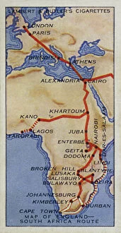
Background imageMaps Collection: Empire Air Routes: Map of England, South Africa Route (colour litho)

Empire Air Routes: Map of England, South Africa Route (colour litho)
8659267 Empire Air Routes: Map of England, South Africa Route (colour litho) by English School, (20th century); Private Collection; (add.info.: Map of England, South Africa Route)

Background imageMaps Collection: India, Physical Map (colour litho)

India, Physical Map (colour litho)
8658798 India, Physical Map (colour litho) by English School, (20th century); Private Collection; (add.info.: India, Physical Map)

Background imageMaps Collection: Ireland, Tudor Period (colour litho)

Ireland, Tudor Period (colour litho)
8652277 Ireland, Tudor Period (colour litho) by English School, (19th century); Private Collection; (add.info.: Ireland, Tudor Period)

Background imageMaps Collection: North Britain, Scotland, Saxon Period (colour litho)

North Britain, Scotland, Saxon Period (colour litho)
8652276 North Britain, Scotland, Saxon Period (colour litho) by English School, (19th century); Private Collection; (add.info.: North Britain, Scotland, Saxon Period)

Background imageMaps Collection: Map of Chelsea (b/w photo)

Map of Chelsea (b/w photo)
8626988 Map of Chelsea (b/w photo) by English School, (19th century); Private Collection; (add.info.: Map of Chelsea, London, showing places of interest for visitors)

Background imageMaps Collection: Map of the Royal Hospital, Chelsea, 1900 (b/w photo)

Map of the Royal Hospital, Chelsea, 1900 (b/w photo)
8626987 Map of the Royal Hospital, Chelsea, 1900 (b/w photo) by English School, (19th century); Private Collection; (add.info.: Map of the Royal Hospital, Chelsea, 1900)

Background imageMaps Collection: The Battle off Gravelines, 8 August 1588, 1590 (hand coloured engraving)

The Battle off Gravelines, 8 August 1588, 1590 (hand coloured engraving)
7340035 The Battle off Gravelines, 8 August 1588, 1590 (hand coloured engraving) by Adams, Robert (1540-95) (after); 43x55 cm; National Maritime Museum, London

Background imageMaps Collection: Dover to Sandwich and Blacknerse to Gravelines - The Spanish Armada

Dover to Sandwich and Blacknerse to Gravelines - The Spanish Armada and the English Fleet off Calais, c
7340034 Dover to Sandwich and Blacknerse to Gravelines - The Spanish Armada and the English Fleet off Calais, c. 1590 (manuscript) by Adams, Robert (1540-95) (after); National Maritime Museum

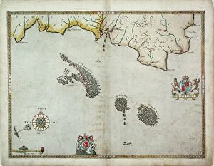
Background imageMaps Collection: The English and Spanish fleets between Portland Bill and the Isle of Wight on 2 - 3 August 1588

The English and Spanish fleets between Portland Bill and the Isle of Wight on 2 - 3 August 1588
7340030 The English and Spanish fleets between Portland Bill and the Isle of Wight on 2 - 3 August 1588, 1590 (coloured engraving) by Adams

Background imageMaps Collection: The English pursue the Spanish fleet east of Plymouth on 31 July - 1 August, 1588

The English pursue the Spanish fleet east of Plymouth on 31 July - 1 August, 1588, c.1590 (coloured engraving)
7340025 The English pursue the Spanish fleet east of Plymouth on 31 July - 1 August, 1588, c.1590 (coloured engraving) by Adams, Robert (1540-95) (after); 38x50 cm; National Maritime Museum, London

Background imageMaps Collection: The route track of the Spanish Armada through the English Channel, into the North Sea

The route track of the Spanish Armada through the English Channel, into the North Sea
7340023 The route track of the Spanish Armada through the English Channel, into the North Sea, around Northern Scotland and into the Atlantic Ocean to return to Spain

Background imageMaps Collection: England, East coast, entrance to the River Humber surveyed by Captain G.E

England, East coast, entrance to the River Humber surveyed by Captain G.E
7339969 England, East coast, entrance to the River Humber surveyed by Captain G.E. Richards HM surveying ship Triton (1899-1900), 1902 (technical drawing) by British School

Background imageMaps Collection: 16th century map of county Limerick, Ireland, c.1588 (paper, linen)

16th century map of county Limerick, Ireland, c.1588 (paper, linen)
7339826 16th century map of county Limerick, Ireland, c.1588 (paper, linen) by Unknown Artist, (16th century); 18x15 cm; National Maritime Museum, London, UK; (add.info.: Creator: unknown Scale: [ca)

Background imageMaps Collection: Central Ireland, Dublin to Sligo, c.1600 (linen, paper)

Central Ireland, Dublin to Sligo, c.1600 (linen, paper)
7339823 Central Ireland, Dublin to Sligo, c.1600 (linen, paper) by Unknown Artist, (17th century); 30x34 cm; National Maritime Museum, London, UK; (add.info.: Creator: unknown Scale: [ca)

Background imageMaps Collection: A ruff draght of Dublin Bay, 1673 (paper, linen)

A ruff draght of Dublin Bay, 1673 (paper, linen)
7339822 A ruff draght of Dublin Bay, 1673 (paper, linen) by Phillips, Thomas (fl.1660-75); 48x37 cm; National Maritime Museum, London, UK; (add.info.: Creator: Thomas Phillips Scale: [ca)

Background imageMaps Collection: Ireland south of Limerick, 1590 (paper, linen)

Ireland south of Limerick, 1590 (paper, linen)
7339812 Ireland south of Limerick, 1590 (paper, linen) by Unknown Artist, (16th century); 78.5x38.5 cm; National Maritime Museum, London, UK; (add.info.: Creator: unknown Scale: [ca. 1:300 000])

Background imageMaps Collection: A general chart exhibiting the discoveries made by Captain James Cook in this

A general chart exhibiting the discoveries made by Captain James Cook in this
7295697 A general chart exhibiting the discoveries made by Captain James Cook in this and his two preceeding voyages with the tracks of the ships under his command, 1794 by Roberts

Background imageMaps Collection: Captain James Cook (1728-1779), 18th century (engraving)

Captain James Cook (1728-1779), 18th century (engraving)
7295541 Captain James Cook (1728-1779), 18th century (engraving) by Sherwin, John Keyse (1751-90); National Maritime Museum, London, UK; (add.info.: Dance-Holland)

Background imageMaps Collection: Harwich Dockyard, 1722 (drawing)

Harwich Dockyard, 1722 (drawing)
7337578 Harwich Dockyard, 1722 (drawing) by Unknown artist, (18th century); National Maritime Museum, London, UK; © National Maritime Museum, Greenwich, London

Background imageMaps Collection: Course of Spanish Armada, British Isles and Ireland, 1588 (print)

Course of Spanish Armada, British Isles and Ireland, 1588 (print)
7419890 Course of Spanish Armada, British Isles and Ireland, 1588 (print); (add.info.: Ornamental map, decorated allegorically)

Background imageMaps Collection: Spithead, 1977 (unknown)

Spithead, 1977 (unknown)
7339302 Spithead, 1977 (unknown) by British School, (20th century) ; 83x60 cm; National Maritime Museum, London, UK; (add.info.: Creator)

Background imageMaps Collection: The tower of St. Aubin, 1680 (coloured engraving)

The tower of St. Aubin, 1680 (coloured engraving)
7339125 The tower of St. Aubin, 1680 (coloured engraving) by Phillips, Thomas (fl.1660-75); 49x70.5 cm; National Maritime Museum, London

Background imageMaps Collection: Nelson explains the Trafalgar battle plan, 1806 (coloured engraving)

Nelson explains the Trafalgar battle plan, 1806 (coloured engraving)
7341898 Nelson explains the Trafalgar battle plan, 1806 (coloured engraving) by Craig, William Marshall (fl.1788-1828) (after); 50.5x34.9 cm; National Maritime Museum, London

Background imageMaps Collection: Sir W Herschell, 1822-23 (engraving, stipple)

Sir W Herschell, 1822-23 (engraving, stipple)
7341639 Sir W Herschell, 1822-23 (engraving, stipple) by Scriven, Edward (1775-1841); 27.6x19 cm; National Maritime Museum, London

Background imageMaps Collection: Map showing the French dominions of Henry II King of england (print)

Map showing the French dominions of Henry II King of england (print)
1000965 Map showing the French dominions of Henry II King of england (print); Private Collection; (add.info.: From Illustrated Easy Stories from English History.)

Background imageMaps Collection: Map Of Dublin, Ireland In 1610. From Our Own Country Published 1898 ©UIG/Leemage

Map Of Dublin, Ireland In 1610. From Our Own Country Published 1898 ©UIG/Leemage
UIG5420274 Map Of Dublin, Ireland In 1610. From Our Own Country Published 1898 ©UIG/Leemage

Background imageMaps Collection: Plan of the Battle of Copenhagen (Denmark) (1801)

Plan of the Battle of Copenhagen (Denmark) (1801)
MMM5484862 Plan of the Battle of Copenhagen (Denmark) (1801); National Maritime Museum, London, UK; (add.info.: Plan of the Battle of Copenhagen (Denmark) (1801)

Background imageMaps Collection: Plan of the positions of the Franco-Spanish fleets at the start of the Battle of Trafalgar (1805)

Plan of the positions of the Franco-Spanish fleets at the start of the Battle of Trafalgar (1805)
MMM5482391 Plan of the positions of the Franco-Spanish fleets at the start of the Battle of Trafalgar (1805). 19th century watercolor.; National Maritime Museum, London

Background imageMaps Collection: Map of Ireland, 17th century (map)

Map of Ireland, 17th century (map)
6117291 Map of Ireland, 17th century (map); (add.info.: Map of Ireland circa 1650-1675 by Dutch engraver, cartographer and publisher Nicolaes Visscher 1); Photo © Ken Welsh

Background imageMaps Collection: Limerick, Ireland under siege in 1690

Limerick, Ireland under siege in 1690
6266297 Limerick, Ireland under siege in 1690; (add.info.: Map of Limerick, Ireland, dating from 1690 and showing the forces of William III besieging the city during the Williamite War of 1689-1691)

Background imageMaps Collection: First World War: Patriotic map showing a little boy and a little girl sends to their father at

First World War: Patriotic map showing a little boy and a little girl sends to their father at the forehead a wooden
LUX4744189 First World War: Patriotic map showing a little boy and a little girl sends to their father at the forehead a wooden crate with a card and kitten

Background imageMaps Collection: A new and correct chart from the Isle of Dogs, to Prittlewell, and the Nore

A new and correct chart from the Isle of Dogs, to Prittlewell, and the Nore, 1797 (technical drawing)
7340037 A new and correct chart from the Isle of Dogs, to Prittlewell, and the Nore, 1797 (technical drawing) by Diston, John (fl.1797); 50.5x71 cm; National Maritime Museum, London

Background imageMaps Collection: River Thames from London Bridge to the Isle of Dogs. A late survey by John Diston of Lowestoff

River Thames from London Bridge to the Isle of Dogs. A late survey by John Diston of Lowestoff, pilot
7340036 River Thames from London Bridge to the Isle of Dogs. A late survey by John Diston of Lowestoff, pilot, master & mariner, 1797 (technical drawing) by Diston

Background imageMaps Collection: An exact survey of the cities of London and Westminster, the borough of Southwark

An exact survey of the cities of London and Westminster, the borough of Southwark
7339846 An exact survey of the cities of London and Westminster, the borough of Southwark, with the country near ten miles round, c.1746 (engraving) by Rocque

Background imageMaps Collection: Chart of the coast of England with the sea decorated with ships and monster, 1584 (paper)

Chart of the coast of England with the sea decorated with ships and monster, 1584 (paper)
7340808 Chart of the coast of England with the sea decorated with ships and monster, 1584 (paper) by Janszoon Waghenaer, Lucas (c.1533-c.1606) ; 40x55 cm; National Maritime Museum, London

Background imageMaps Collection: A plan of the city of London, Westminster, borough of Southwark & the river Thames, 1721 (print)

A plan of the city of London, Westminster, borough of Southwark & the river Thames, 1721 (print)
7340744 A plan of the city of London, Westminster, borough of Southwark & the river Thames, 1721 (print) by Unknown artist, (18th century); National Maritime Museum, London


All Professionally Made to Order for Quick Shipping


-

Maps Collection

The Republic of Ireland is located in the North Atlantic Ocean and is part of Europe. Maps of the Republic of Ireland are widely available, both online and in print. These maps typically show the country's major cities, rivers, lakes, mountains, national parks and other features. They also often include information about roads and other transportation networks as well as political boundaries. They can useful for travelers who wish to explore the country or plan a route from one destination to another. Additionally, they can be used by businesses looking to expand their operations into new markets or investors seeking potential opportunities in different parts of the country.
+

Our beautiful Wall Art and Photo Gifts include Framed Prints, Photo Prints, Poster Prints, Canvas Prints, Jigsaw Puzzles, Metal Prints and so much more

The Maps of Republic of Ireland Europe collection from Media Storehouse is a stunning range of wall art and framed prints that showcase the beauty and diversity of Ireland's landscapes. Our collection features an extensive selection of maps, including antique maps, topographical maps, and modern-day roadmaps. Each print in our collection is carefully crafted to capture the unique character and charm of Ireland's cities, towns, villages, mountains, lakes, rivers and coastlines. Whether you are looking for a striking piece to hang in your home or office or want to give a thoughtful gift to someone special who loves Irish culture and history - our collection has something for everyone. From Dublin's bustling streets to the rugged beauty of Connemara National Park; from the ancient ruins at Newgrange to the rolling hillsides dotted with sheep - these prints offer a glimpse into one of Europe's most enchanting countries. With its rich history, vibrant culture and breathtaking scenery - it's no wonder why so many people fall in love with Ireland.
+

What are Maps of Republic of Ireland Europe art prints?

Maps of Republic of Ireland Europe art prints are high-quality reproductions of maps that depict the geography and topography of the Republic of Ireland. These prints showcase intricate details such as cities, towns, rivers, mountains, and other landmarks that make up the Irish landscape. They are designed to be visually appealing and informative at the same time. These art prints are perfect for anyone who loves history or geography or has an interest in exploring new places. They can be used to decorate homes, offices, schools or any space where a touch of sophistication is needed. Maps of Republic of Ireland Europe art prints come in various sizes and styles to suit different preferences. These art prints offer a unique way to appreciate the beauty and complexity of one's surroundings while also providing valuable information about them. Whether you're looking for a decorative piece or something more educational, Maps of Republic of Ireland Europe art prints from Media Storehouse are sure to impress.
+

What Maps of Republic of Ireland Europe art prints can I buy from Media Storehouse?

We offer a wide range of Republic of Ireland Europe art prints that are perfect for those who want to add a touch of elegance and sophistication to their home or office. These maps showcase the beauty and intricacy of the region, highlighting its unique features and landmarks. Some popular options include vintage-style maps that capture the history and charm of Ireland, as well as modern designs that offer a fresh take on this stunning country. You can choose from different sizes, styles, and finishes to suit your preferences. Whether you're looking for a statement piece or something more subtle, we have plenty of options to choose from. Their high-quality prints are made using premium materials that ensure they look great for years to come. So if you want to bring some Irish flair into your space, be sure to check out their selection today.
+

How do I buy Maps of Republic of Ireland Europe art prints?

To buy Maps of Republic of Ireland Europe art prints from Media Storehouse, you can browse our extensive collection online. Simply search for the specific map or artwork that you are interested in and add it to your cart. You can also refine your search by selecting different categories such as size, orientation, and color. Once you have added all the items to your cart, proceed to checkout where you will be prompted to enter your shipping and payment information. After completing the purchase process, Media Storehouse will process your order and ship it directly to your desired location. We offer a wide range of high-quality art prints featuring maps of Republic of Ireland Europe that are perfect for decorating any space in your home or office. Whether you're looking for a vintage-style map or a modern interpretation, they have something for everyone's taste and budget. So start exploring our collection today.
+

How much do Maps of Republic of Ireland Europe art prints cost?

As We offer a wide range of maps of the Republic of Ireland and Europe art prints, the cost may vary depending on factors such as size, framing options, and printing materials. However, you can be assured that they will receive high-quality prints at reasonable prices. The company sources its images from top photographers and archives worldwide to ensure that our collection is diverse and unique. Our maps of the Republic of Ireland and Europe art prints are perfect for those who want to add a touch of sophistication to their home or office decor. These prints come in various sizes ranging from small to large formats, making them suitable for any space. You can choose between unframed or framed options based on their preferences. We provide excellent value for money when it comes to purchasing maps of the Republic of Ireland and Europe art prints. Their products are affordable yet maintain exceptional quality standards that meet customer expectations.
+

How will my Maps of Republic of Ireland Europe art prints be delivered to me?

Your Maps of Republic of Ireland Europe art prints will be delivered to you in a safe and secure manner. We take great care in packaging your order so that it arrives at your doorstep without any damage. The prints are carefully rolled and placed inside a sturdy tube, which is then sealed with protective caps on both ends. We use reliable courier services to deliver your order, ensuring that it reaches you within the estimated delivery time frame. You can track your package using the tracking number provided once it has been dispatched from our warehouse. We understand how important it is for our customers to receive their orders promptly and in perfect condition. That's why we have partnered with trusted shipping companies who share our commitment to quality service. Rest assured that when you order Maps of Republic of Ireland Europe art prints from us, they will be delivered to you safely and efficiently.