Premium Framed Print > Maps and Charts > Related Images
Premium Framed Print : Plan of Navigable Rivers and Canals connected with the Aire and Calder Navigation; with a Proposed Canal from Knottingley to Goole, 1818


![]()
Framed Photos from Sheffield City Archives
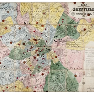
Plan of Navigable Rivers and Canals connected with the Aire and Calder Navigation; with a Proposed Canal from Knottingley to Goole, 1818
Scale 1.3 inches : 10 miles.Size 43 x 28 cm.Original at Local Studies A1S
Sheffield City Archives and Local Studies Library has an unrivalled collection of images of Sheffield, England
Media ID 14047766
© Sheffield City Council
Canals Maps Transport Water Aire Calder
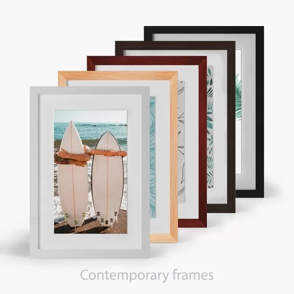
14"x18" Premium Frame
Contemporary style Premium Wooden Frame with 8"x12" Print. Complete with 2" White Mat and 1.25" thick MDF frame. Printed on 260 gsm premium paper. Glazed with shatter proof UV coated acrylic glass. Backing is paper covered backing with rubber bumpers. Supplied ready to hang with a pre-installed sawtooth/wire hanger. Care Instructions: Spot clean with a damp cloth. Securely packaged in a clear plastic bag and envelope in a reinforced cardboard shipper
FSC Real Wood Frame and Double Mounted with White Conservation Mountboard - Professionally Made and Ready to Hang
Estimated Image Size (if not cropped) is 30.4cm x 20.3cm (12" x 8")
Estimated Product Size is 45.8cm x 35.6cm (18" x 14")
These are individually made so all sizes are approximate
Artwork printed orientated as per the preview above, with landscape (horizontal) orientation to match the source image.
FEATURES IN THESE COLLECTIONS
> Maps and Charts
> Related Images
> Sheffield City Archives
> Maps and Plans
EDITORS COMMENTS
This print from Sheffield City Archives showcases the intricate "Plan of Navigable Rivers and Canals connected with the Aire and Calder Navigation; with a Proposed Canal from Knottingley to Goole" dating back to 1818. The map, measuring 43 x 28 cm, offers an intriguing glimpse into the historical significance of water transport in this region. With its detailed depiction of rivers, canals, and navigation routes, this map provides valuable insights into the transportation infrastructure that once thrived along the Aire and Calder rivers. It highlights how these waterways were ingeniously interconnected through a network of canals, facilitating trade and commerce during that era. The scale of 1.3 inches : 10 miles allows viewers to appreciate both the grandeur and intricacy involved in planning such an extensive system. This visual representation not only serves as a testament to human ingenuity but also sheds light on how vital these water routes were for transporting goods across vast distances. Of particular interest is the proposed canal from Knottingley to Goole depicted on this map. Its inclusion hints at ambitious plans for further expanding navigational capabilities in order to accommodate growing demands for trade. Preserved within Sheffield City Archives' Local Studies collection, this print invites us to explore our rich industrial heritage by delving into the fascinating world of maps, canals, waterways, and their crucial role in shaping regional development centuries ago.
MADE IN THE USA
Safe Shipping with 30 Day Money Back Guarantee
FREE PERSONALISATION*
We are proud to offer a range of customisation features including Personalised Captions, Color Filters and Picture Zoom Tools
SECURE PAYMENTS
We happily accept a wide range of payment options so you can pay for the things you need in the way that is most convenient for you
* Options may vary by product and licensing agreement. Zoomed Pictures can be adjusted in the Cart.