Jigsaw Puzzle > Arts > Artists > K > Korean School Korean School
Jigsaw Puzzle : Chonhado (World Map)
")
")
![]()
Jigsaw Puzzles from Fine Art Finder
Chonhado (World Map)
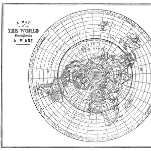
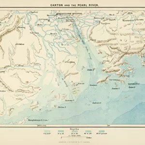
3086646 Chonhado (World Map) by Korean school, (18th century); Private Collection; (add.info.: Korean traditional map of all under heaven presents a flat world with Korea and China in the centre.
); Korean, out of copyright
Media ID 18257693
© Private Collection / Bridgeman Images
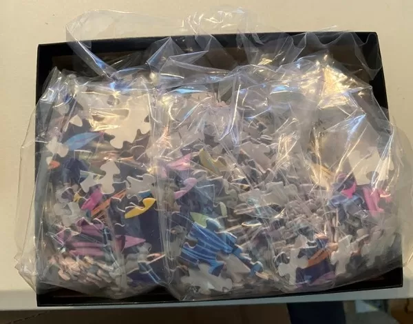
Jigsaw Puzzle (520 Pieces)
Discover the wonders of the world with our Chonhado Jigsaw Puzzle from Media Storehouse. This beautiful puzzle features the intriguing "Chonhado (World Map)" from the Korean school of the 18th century, as seen on Fine Art Finder (3086646). With Korea and China at the center, this traditional map presents a unique perspective of the world. Engage in a captivating puzzle experience, connecting pieces to reveal the rich cultural history and intricate details of this fascinating world map.
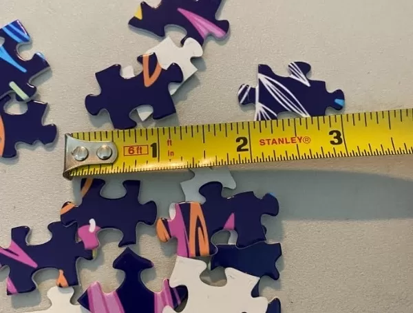
Made in the USA, 520-piece puzzles measure 16" x 20" (40.6 x 50.8 cm). Every puzzle is meticulously printed on glossy photo paper, which has a strong 1.33 mm thickness. Delivered in a black storage cardboard box, these puzzles are both stylish and practical. (Note: puzzles contain small parts and are not suitable for children under 3 years of age.)
Jigsaw Puzzles are an ideal gift for any occasion
Estimated Product Size is 50.8cm x 40.5cm (20" x 15.9")
These are individually made so all sizes are approximate
Artwork printed orientated as per the preview above, with landscape (horizontal) or portrait (vertical) orientation to match the source image.
FEATURES IN THESE COLLECTIONS
> Arts
> Artists
> K
> Korean School Korean School
> Maps and Charts
> Flat Earth
> Maps and Charts
> Related Images
> Maps and Charts
> World
EDITORS COMMENTS
This print showcases the Chonhado, a remarkable 18th-century Korean world map. With its intricate details and historical significance, this piece of cartography takes us back in time to a period when Korea and China were at the center of the known world. The Chonhado presents a unique perspective on global geography, depicting a flat earth with Korea and China as focal points. As we explore this ancient map, we are transported to an era where exploration was limited yet curiosity about distant lands prevailed. The craftsmanship evident in this manuscript is truly awe-inspiring. Every stroke of ink reveals the meticulous attention to detail that went into creating such an exquisite work of art. The delicate lines trace coastlines, rivers, mountains, and cities across Asia and beyond. As we delve deeper into this visual treasure trove of knowledge, it becomes clear that the Chonhado not only serves as a geographical representation but also offers insights into cultural exchanges between nations during that time. It reminds us how maps have always been more than just tools for navigation; they are windows into history itself. This particular photograph allows us to appreciate the beauty and significance of this Korean masterpiece from centuries ago. Its presence in private collections ensures its preservation for generations to come so that we may continue to marvel at its artistic brilliance and historical importance.
MADE IN THE USA
Safe Shipping with 30 Day Money Back Guarantee
FREE PERSONALISATION*
We are proud to offer a range of customisation features including Personalised Captions, Color Filters and Picture Zoom Tools
SECURE PAYMENTS
We happily accept a wide range of payment options so you can pay for the things you need in the way that is most convenient for you
* Options may vary by product and licensing agreement. Zoomed Pictures can be adjusted in the Cart.