Fraud Blocker Skip to main content

Home > Universal Images Group (UIG) > Art > Painting, Sculpture & Prints > Cartography

Cartography Collection (#4)

953 Items

We are proud to offer this selection in partnership with Universal Images Group (UIG)

Background imageCartography Collection: Planisphere from Theatrum Orbis Terrarum by Abraham Ortelius, printed in Antwerp, 1570

Planisphere from Theatrum Orbis Terrarum by Abraham Ortelius, printed in Antwerp, 1570
Cartography, 16th century. Planisphere, from Theatrum Orbis Terrarum by Abraham Ortelius (1528-1598), Antwerp, 1570

Background imageCartography Collection: Map of Brazil, from Miller Atlas, by Pedro and Jorge Reinel, Lopo Homen

Map of Brazil, from Miller Atlas, by Pedro and Jorge Reinel, Lopo Homen, cartographers and Antonio de Holanda
Cartography, 16th century. Map of Brazil, from Miller Atlas, by Pedro and Jorge Reinel, Lopo Homen (cartographers) and Antonio de Holanda (miniaturist), 1519

Background imageCartography Collection: Map of Northern Africa, from Theatrum Orbis Terrarum by Abraham Ortelius, 1528-1598, 1570

Map of Northern Africa, from Theatrum Orbis Terrarum by Abraham Ortelius, 1528-1598, 1570
Cartography, 16th century. Map of Northern Africa, from Theatrum Orbis Terrarum by Abraham Ortelius (1528-1598), Antwerp, 1570

Background imageCartography Collection: Map of Martinique created by Matthieu Seutter, details: Merchants and Native American Indian

Map of Martinique created by Matthieu Seutter, details: Merchants and Native American Indian
Cartography, 18th century. Map of Martinique created by Matthieu Seutter. Details: Merchants and Native American Indian

Background imageCartography Collection: Map of Western Africa, by Lazaro Luis, from the Atlas, 1563

Map of Western Africa, by Lazaro Luis, from the Atlas, 1563
Cartography, 16th century. Map of Western Africa. From the Atlas by Lazaro Luis, 1563

Background imageCartography Collection: Planisphere of the universe according to Nicolaus Copernicus, 1473-1543

Planisphere of the universe according to Nicolaus Copernicus, 1473-1543
Astronomy. Planisphere of the universe according to Nicolaus Copernicus (1473-1543)

Background imageCartography Collection: Map of Goa, flourishing Portuguese colony in the Indian peninsula, 1635

Map of Goa, flourishing Portuguese colony in the Indian peninsula, 1635
Cartography, 17th century. Map of Goa, flourishing Portuguese colony in the Indian peninsula, 1635

Background imageCartography Collection: Piedmont, Monferrato and Liguria Regions, Map by Gerhard Kremer, from Regionum Italiae

Piedmont, Monferrato and Liguria Regions, Map by Gerhard Kremer, from Regionum Italiae, Copper engraving, 1628
Cartography, Italy, 17th century. Piedmont, Monferrato and Liguria Regions. Map by Gerhard Kremer, from Regionum Italiae, 1628. Copper engraving

Background imageCartography Collection: Triangulation of perpendicular to meridian of Observatory, eastern part, pen drawing, 1734

Triangulation of perpendicular to meridian of Observatory, eastern part, pen drawing, 1734
Cartography, France, 18th century. Triangulation of the perpendicular to the meridian of the Observatory (eastern part), 1734. Pen drawing. 36 x 54 cm

Background imageCartography Collection: State of Genoa and Nice County. From the French atlas Military France, 1838

State of Genoa and Nice County. From the French atlas Military France, 1838
Cartography, Italy, 19th century. State of Genoa and Nice County. From the French atlas Military France, 1838

Background imageCartography Collection: Map of Nordic countries and Lapland, by Olaus Magnus, from Carta Marina, Sea Map, 1539

Map of Nordic countries and Lapland, by Olaus Magnus, from Carta Marina, Sea Map, 1539
Cartography, 16th century. Map of Nordic countries and Lapland. From Carta Marina (Sea Map) by Olaus Magnus, 1539

Background imageCartography Collection: Eastern Liguria Region, From the Atlas of Italy by Giovanni Antonio Magini, Copper engraving, 1613

Eastern Liguria Region, From the Atlas of Italy by Giovanni Antonio Magini, Copper engraving, 1613
Cartography, Italy 16th century. Eastern Liguria Region. From the Atlas of Italy by Giovanni Antonio Magini, 1613. Copper engraving

Background imageCartography Collection: Ferrara at the time of the Marquis Nicolo Zoppo d Este, 1338

Ferrara at the time of the Marquis Nicolo Zoppo d Este, 1338
Cartography, Italy, 17th century. Ferrara at the time of the Marquis NicolA

Background imageCartography Collection: Map of Liguria, 2nd part, by Joseph Chaffrion, Copper engraving, 1685

Map of Liguria, 2nd part, by Joseph Chaffrion, Copper engraving, 1685
Cartography, Italy, 17th century. Map of Liguria (2nd part), by Joseph Chaffrion, 1685. Copper engraving

Background imageCartography Collection: Nautical chart of the Central-Eastern Mediterranean Sea, detail with Turkey

Nautical chart of the Central-Eastern Mediterranean Sea, detail with Turkey
Cartography, 16th century. Nautical chart of the Central-Eastern Mediterranean Sea, detail with Turkey, by Giorgio Sideri called Callapoda or Calopodio da Candia (Crete)

Background imageCartography Collection: Italy, Naples, map by Stephan Du Perac drawing by Antonio Lafreri, engraving

Italy, Naples, map by Stephan Du Perac drawing by Antonio Lafreri, engraving 1712, Museo Nazionale di San Martino

Background imageCartography Collection: Map of Palermo from Civitates Orbis Terrarum by Georg Braun, 1541-1622 and Franz Hogenberg

Map of Palermo from Civitates Orbis Terrarum by Georg Braun, 1541-1622 and Franz Hogenberg, 1540-1590, engraving
Cartography, Italy, 16th century. Map of Palermo. From Civitates Orbis Terrarum by Georg Braun (1541-1622) and Franz Hogenberg (1540-1590), Cologne. Engraving

Background imageCartography Collection: Map of Turkey and Cyprus, by Stefano Buonsignori, oil painting, 1575-1584

Map of Turkey and Cyprus, by Stefano Buonsignori, oil painting, 1575-1584
Italy - Tuscany region - Florence. Palazzo Vecchio, Hall of the Geographical Maps. Map of Turkey and Cyprus, oil painting by Stefano Buonsignori 1575-1584

Background imageCartography Collection: Map of Africa and South America by Domingo Sanchez, 1618

Map of Africa and South America by Domingo Sanchez, 1618
Cartography, 17th century. Map of Africa and South America by Domingo Sanchez, 1618

Background imageCartography Collection: Map of Catania from Civitates Orbis Terrarum by Georg Braun, 1541-1622 and Franz Hogenberg

Map of Catania from Civitates Orbis Terrarum by Georg Braun, 1541-1622 and Franz Hogenberg, 1540-1590, engraving
Cartography, Italy, 16th century. Map of Catania. From Civitates Orbis Terrarum by Georg Braun (1541-1622) and Franz Hogenberg (1540-1590), Cologne. Engraving

Background imageCartography Collection: Monferrato region, Map by Vincenzo Maria Coronelli from his atlas Atlante Veneto

Monferrato region, Map by Vincenzo Maria Coronelli from his atlas Atlante Veneto, Copper engraving, 1690
Cartography, Italy, 17th century. Monferrato region. Map by Vincenzo Maria Coronelli from his atlas Atlante Veneto, 1690. Copper engraving

Background imageCartography Collection: Map of Piedmont, of the Savoy and Genovas. Cremona, engraving on copper, 1832

Map of Piedmont, of the Savoy and Genovas. Cremona, engraving on copper, 1832
Cartography, Italy, 19th century. Map of Piedmont, of the Savoy and Genovas. Cremona, 1832. Engraving on copper

Background imageCartography Collection: Map of Sardinia region, by Joan Blaeu

Map of Sardinia region, by Joan Blaeu
Cartography, Italy, 17th century. Map of Sardinia region, by Joan Blaeu

Background imageCartography Collection: Map of Vienna and Buda from Civitates Orbis Terrarum by Georg Braun

Map of Vienna and Buda from Civitates Orbis Terrarum by Georg Braun, 1541-1622 and Franz Hogenberg, 1540-1590
Cartography, Austria and Hungary, 16th century. Map of Vienna and Buda. From Civitates Orbis Terrarum by Georg Braun (1541-1622) and Franz Hogenberg (1540-1590), Cologne. Engraving

Background imageCartography Collection: Map of Northern Africa from World map by Camaldolese monk Fra Mauro, 1449 Detail

Map of Northern Africa from World map by Camaldolese monk Fra Mauro, 1449 Detail
Cartography, 15th century. Map of Northern Africa. From World map by Camaldolese monk Fra Mauro, 1449. Detail

Background imageCartography Collection: Map of Italy by Abraham Ortelius, 1528-1598, from Theatrum Orbis Terrarum, 1570

Map of Italy by Abraham Ortelius, 1528-1598, from Theatrum Orbis Terrarum, 1570
Cartography, Italy, 16th century. Map of Italy by Abraham Ortelius (1528-1598), from Theatrum Orbis Terrarum, 1570

Background imageCartography Collection: Brabant from Theatrum Orbis Terrarum by Willem Bleau, Amsterdam, 1635-1645

Brabant from Theatrum Orbis Terrarum by Willem Bleau, Amsterdam, 1635-1645
Cartography, Netherlands, 17th century. Brabant. From Theatrum Orbis Terrarum by Willem Bleau, Amsterdam. 1635-1645

Background imageCartography Collection: The Glorious Campaign of the Duke of Anguyen, commander of the armies Louis XIII

The Glorious Campaign of the Duke of Anguyen, commander of the armies Louis XIII
Cartography, France, 17th century. The glorious campaign of the Duke of Anguyen, commander of the armies Louis XIII, King of France and Navarra, 1644

Background imageCartography Collection: Map of area of Maletto, Catania province, Sicily region

Map of area of Maletto, Catania province, Sicily region
Cartography, Italy, 19th century. Map of the area of Maletto, Catania province, Sicily region

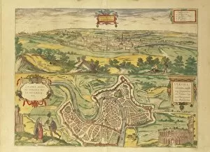
Background imageCartography Collection: Map of Verona from Civitates Orbis Terrarum by Georg Braun, 1541-1622 and Franz Hogenberg

Map of Verona from Civitates Orbis Terrarum by Georg Braun, 1541-1622 and Franz Hogenberg, 1540-1590, engraving
Cartography, Italy, 16th century. Map of Verona, from Civitates Orbis Terrarum by Georg Braun (1541-1622) and Franz Hogenberg (1540-1590), Cologne. Engraving

Background imageCartography Collection: Map of city, from Civitates Orbis Terrarum by Georg Braun, 1541-1622 and Franz Hogenberg

Map of city, from Civitates Orbis Terrarum by Georg Braun, 1541-1622 and Franz Hogenberg, 1540-1590, engraving
Cartography, Netherlands, 16th century. Map of Amsterdam. From Civitates Orbis Terrarum by Georg Braun (1541-1622) and Franz Hogenberg (1540-1590), Cologne. Engraving

Background imageCartography Collection: Map of South America and Strait of Magellan from Luis Lazaros world atlas, 1563

Map of South America and Strait of Magellan from Luis Lazaros world atlas, 1563
Cartography, 16th century. South America and the Strait of Magellan from Luis Lazaros world atlas, 1563

Background imageCartography Collection: Map of Nocera and Castelnuovo from Civitates Orbis Terrarum by Georg Braun

Map of Nocera and Castelnuovo from Civitates Orbis Terrarum by Georg Braun, 1541-1622 and Franz Hogenberg, 1540-1590
Cartography, Italy, 16th century. Map of Nocera and Castelnuovo. From Civitates Orbis Terrarum by Georg Braun (1541-1622) and Franz Hogenberg (1540-1590), Cologne. Engraving

Background imageCartography Collection: Eastern Liguria Region, Copper engraving

Eastern Liguria Region, Copper engraving
Cartography, Italy, 18th century. Eastern Liguria Region. Copper engraving

Background imageCartography Collection: World map by Giovanni Contarini, 1506

World map by Giovanni Contarini, 1506
Cartography, 16th century. World map created by Giovanni Contarini, 1506

Background imageCartography Collection: Nautical chart of the Central-Eastern Mediterranean Sea and wind roses

Nautical chart of the Central-Eastern Mediterranean Sea and wind roses, second chart from a nautical atlas of
Cartography, 17th century. Nautical chart of the Central-Eastern Mediterranean Sea and wind roses. Second chart, from a nautical atlas of the Mediterranean Sea in three charts

Background imageCartography Collection: Map of Vicenza from Civitates Orbis Terrarum by Georg Braun, 1541-1622 and Franz Hogenberg

Map of Vicenza from Civitates Orbis Terrarum by Georg Braun, 1541-1622 and Franz Hogenberg, 1540-1590, engraving
Cartography, Italy, 16th century. Map of Vicenza. From Civitates Orbis Terrarum by Georg Braun (1541-1622) and Franz Hogenberg (1540-1590), Cologne. Engraving

Background imageCartography Collection: Pacific Ocean, from Atlas of the World in thirty-three Maps, by Battista Agnese, 1553

Pacific Ocean, from Atlas of the World in thirty-three Maps, by Battista Agnese, 1553
Cartography, 16th century. The Pacific Ocean, from Atlas of the World in thirty-three Maps, by Battista Agnese, 1553

Background imageCartography Collection: The territory of Genoa. Map by John Luffman from Select Plans of the Principal Cities, Harbors

The territory of Genoa. Map by John Luffman from Select Plans of the Principal Cities, Harbors, Forts in the World
Cartography, Italy, 19th century. The territory of Genoa. Map by John Luffman from Select Plans of the Principal Cities, Harbors, Forts in the World. London, 1800. Copper engraving

Background imageCartography Collection: Planisphere from Cosmographie Universelle by Guillame le Testu, engraving, 1555

Planisphere from Cosmographie Universelle by Guillame le Testu, engraving, 1555
Cartography, 16th century. Planisphere from Cosmographie Universelle by Guillame le Testu, 1555. Engraving

Background imageCartography Collection: Venice and Genoa, Italy, from portolan chart by Francesco Oliva, 1566

Venice and Genoa, Italy, from portolan chart by Francesco Oliva, 1566
Cartography, Italy, 16th century. Venice and Genoa. From a portolan chart by Francesco Oliva, 1566

Background imageCartography Collection: Map of Madagascar Island, from Isolario dell Atlante Veneto, Volume II, by Vincenzo Coronelli

Map of Madagascar Island, from Isolario dell Atlante Veneto, Volume II, by Vincenzo Coronelli, copperplate
Cartography, 17th century. Madagascar Island, From the Isolario dell Atlante Veneto, Volume II, by Vincenzo Coronelli, Venice 1696-1697. Copper print on paper. 61 x 45.5 cm

Background imageCartography Collection: Helsingborg, Lund, Malmo, Elbogen and Landskrona from Civitates Orbis Terrarum by Georg Braun

Helsingborg, Lund, Malmo, Elbogen and Landskrona from Civitates Orbis Terrarum by Georg Braun
Cartography, Sweden, 16th century. Helsingborg, Lund, Malmo (Elbogen) and Landskrona. From Civitates Orbis Terrarum by Georg Braun (1541-1622) and Franz Hogenberg (1540-1590), Cologne. Engraving

Background imageCartography Collection: Aegean Sea, from portolan atlas consisting of six charts, by Placido Caloiro and Francesco Oliva

Aegean Sea, from portolan atlas consisting of six charts, by Placido Caloiro and Francesco Oliva, Parchment. 1646
Cartography, 17th century. Aegean Sea, from a portolan atlas consisting of six charts, by Placido Caloiro and Francesco Oliva, 1646. Parchment

Background imageCartography Collection: Paris city plan, by Sebastian Munster, 1530

Paris city plan, by Sebastian Munster, 1530
Cartography, France, 16th century - Paris city plan, 1530, by Sebastian Munster

Background imageCartography Collection: Map of Bar-Le-Duc from Civitates Orbis Terrarum by Georg Braun, 1541-1622 and Franz Hogenberg

Map of Bar-Le-Duc from Civitates Orbis Terrarum by Georg Braun, 1541-1622 and Franz Hogenberg, 1540-1590, engraving
Cartography, France, 16th century. Map of Bar-Le-Duc. From Civitates Orbis Terrarum by Georg Braun (1541-1622) and Franz Hogenberg (1540-1590), Cologne. Engraving

Background imageCartography Collection: Map of Chiquatzin, Tecuihtli territory, Mexico

Map of Chiquatzin, Tecuihtli territory, Mexico
Cartography, Mexico, 16th century. Map of the Chiquatzin Tecuihtli territory

Background imageCartography Collection: Map of North-Western Italy and Savoy, By Nicolas Sanson from French atlas, Copper engraving, 1643

Map of North-Western Italy and Savoy, By Nicolas Sanson from French atlas, Copper engraving, 1643
Cartography, Italy, 17th century. Map of North-Western Italy and Savoy. By Nicolas Sanson from a French atlas, 1643. Copper engraving


All Professionally Made to Order for Quick Shipping


-

Why Choose Us?

We are a leading provider of Art Prints and Photo Gifts since 2003, working in partnership with a range of Sporting Clubs, Charities, Museums and Picture Libraries. A large share of profits from any of their images will go directly towards supporting that charity or club. Our archive of images is carefully curated to bring you a wide range of subjects, including landscapes, wildlife, architecture, and more. We ship from our partner labs in the UK, USA, EU (Netherlands) and Australia.
+

How do I place an order?

Ordering is quick & easy - Just follow 5 Simple Steps:
  1. Find your image: Use our search box or browse our online photo Collections to find the image you want.

  2. Choose your print format: Select your desired product and add it to your cart.

  3. Enter your details: If you're a returning customer, simply enter your email address and password, and we'll fill in your billing and shipping address details. All personal details are held securely and are fully GDPR compliant. As standard, we remove all Personally Identifiable Information after 12 months.

  4. Pay for your purchase: We use state-of-the-art security for online shopping and do not have access to your card details.

  5. Sit back and relax: We'll email you confirmation of your order and when it's dispatched. Registered customers can also track orders in the 'My Account' area.

+

How do I pay for an order?

You can pay for your order with most of the major credit and debit cards, or PayPal. For added security, major financial institutions process payment details separately and securely on our behalf. We do not have access to your online payment card details. Online payments are preferred however we do take phone orders. For UK customers only we accept cheques issued against a UK bank.
+

Is my data safe?

We take data security very seriously. We do not have access to your full card details and all payments are requested over a fully secure connection. Additionally, we fully comply with current European and GDPR legislation, and automatically remove all personal data after at most 12 months (unless you have an account with us and have signed in recently). We also have a strict opt-in policy and would never sell your personal details. Your data is only used to fulfill your order promptly and efficiently.
+

Is wall art ready to hang?

For quick and easy installation all wall art, including framed prints, canvas prints and metal prints are supplied with a ready to hang solution on the back. Generally, saw tooth hangers are applied as they allow wall art to hang flush against the wall. The serrated edge of the hanger prevents the frame from shifting or tilting when hung.
+

Are the photo prints fade resistant?

Yes, we use archival quality photo paper photographic paper for vivid reproduction Prints are an accurate representations of the original artwork, which is preserved for artistic character and authenticity. We guarantee they match previews shown on our web site