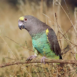
Home > Animals > Birds > Accipitriformes > Accipitridae > Upland Buzzard
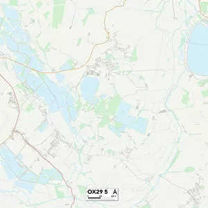
Cherwell OX17 1 Map

![]()
Wall Art and Photo Gifts from Map Marketing
Cherwell OX17 1 Map
Postcode Sector Map of Cherwell OX17 1
Media ID 19977329
Angelica Close Appletree Road Bakehouse Lane Banbury Road Byfield Road Camp Lane Chapel Lane Chapel Street Cherwell Chestnut Road Church Close Church Hill Church Lane Court Close Crow Lane Forge Lane High Street Ivy Lane Main Street Manor Close Manor Park Manor Road March Road Meadowsweet Way Middle Lane Mill Lane New Road Orchard View Park Close Rectory Close Red Lion Street Roundhill Road Sage Close School Hill School Lane South View Southam Road Spring Lane Springfield Station Road Swan Lane The Close The Green The Holloway The Holt The Mead The Paddocks The Plantation The Slade Thorpe Road Valley View Vernon Way Vicarage Gardens Village Road Watts Road Whiteway Windmill Lane Claydon Cropredy Cup And Saucer Farnborough Hanwell Long Barrow
FEATURES IN THESE COLLECTIONS
> Animals
> Birds
> Accipitriformes
> Accipitridae
> Upland Buzzard
> Animals
> Birds
> Passerines
> Crows And Jays
> Related Images
> Europe
> United Kingdom
> England
> Avon
> Map Marketing
> Postcode Sector Maps
> OX - Oxford
> Map Marketing
> UK Maps
> Maps and Charts
> Related Images
MADE IN THE USA
Safe Shipping with 30 Day Money Back Guarantee
FREE PERSONALISATION*
We are proud to offer a range of customisation features including Personalised Captions, Color Filters and Picture Zoom Tools
SECURE PAYMENTS
We happily accept a wide range of payment options so you can pay for the things you need in the way that is most convenient for you
* Options may vary by product and licensing agreement. Zoomed Pictures can be adjusted in the Cart.