Home > Europe > United Kingdom > Wales > Pembrokeshire > St Davids
Wolverhampton WV1 1 Map

![]()
Wall Art and Photo Gifts from Map Marketing
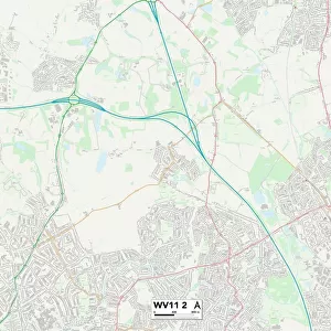
Wolverhampton WV1 1 Map
Postcode Sector Map of Wolverhampton WV1 1
Media ID 19983296
A449 Berry Street Broad Street Camp Street Cheapside Corporation Street Crown Street Dudley Street Exchange Street Herbert Street King Street Lichfield Street Lock Street Long Street North Road North Street Nursery Street Paternoster Row Princes Square Princess Street Queen Square Queen Street Railway Street Short Street Southampton Street St Marys Street St Peters Square Stafford Street The Maltings Westbury Street Wolverhampton
FEATURES IN THESE COLLECTIONS
> Animals
> Mammals
> Muridae
> Peters Mouse
> Europe
> United Kingdom
> Wales
> Pembrokeshire
> St Davids
> Map Marketing
> Postcode Sector Maps
> WV - Wolverhampton
> Maps and Charts
> Related Images
> Popular Themes
> Railway Posters
MADE IN THE USA
Safe Shipping with 30 Day Money Back Guarantee
FREE PERSONALISATION*
We are proud to offer a range of customisation features including Personalised Captions, Color Filters and Picture Zoom Tools
SECURE PAYMENTS
We happily accept a wide range of payment options so you can pay for the things you need in the way that is most convenient for you
* Options may vary by product and licensing agreement. Zoomed Pictures can be adjusted in the Cart.