Home > Europe > United Kingdom > England > London > Towns > Grange Park
Southend-on-Sea SS9 2 Map

![]()
Wall Art and Photo Gifts from Map Marketing
Southend-on-Sea SS9 2 Map
Postcode Sector Map of Southend-on-Sea SS9 2
Media ID 19978804
Berkeley Gardens Burnham Road Castle Drive Chapmans Close Crescent Road Dale Road Glendale Gardens Grange Road Hadleigh Road Hampton Court Harley Street Hazel Close High Street Hillside Road Laurel Close London Road Marine Avenue Marine Close Marine Parade New Road Park Road Percy Road Rectory Grove Salisbury Road Southend On Sea Thames Close Thames Drive Vernon Road Western Road Leigh On Sea Theobalds Road
FEATURES IN THESE COLLECTIONS
> Europe
> United Kingdom
> England
> London
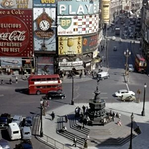
> Events
> Parades
> Related Images
> Europe
> United Kingdom
> England
> London
> Sights
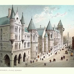
> High Court
> Europe
> United Kingdom
> England
> London
> Towns
> Grange Park
> Europe
> United Kingdom
> England
> London
> Towns
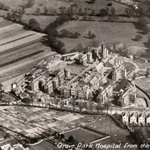
> Grove Park
> Europe
> United Kingdom
> England
> London
> Towns
> Hampton
> Europe
> United Kingdom
> England
> London
> Towns
> West Hill
> Map Marketing
> Postcode Sector Maps
> SS - Southend-on-Sea
> North America
> United States of America
> New York
> New York
> Bridges
> Broadway Bridge
> North America
> United States of America
> New York
> New York
> Brooklyn
> Marine Park
MADE IN THE USA
Safe Shipping with 30 Day Money Back Guarantee
FREE PERSONALISATION*
We are proud to offer a range of customisation features including Personalised Captions, Color Filters and Picture Zoom Tools
SECURE PAYMENTS
We happily accept a wide range of payment options so you can pay for the things you need in the way that is most convenient for you
* Options may vary by product and licensing agreement. Zoomed Pictures can be adjusted in the Cart.