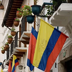
Home > South America > Ecuador > Ecuador Heritage Sites > City of Quito
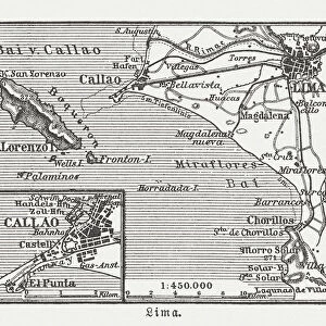
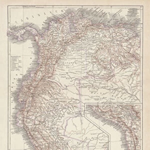
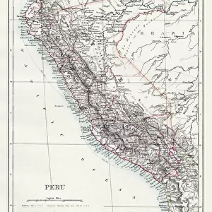
Map of the Pacific coast along the present nations of Ecuador and Peru, with villages of Quito

![]()
Wall Art and Photo Gifts from Heritage Images
Map of the Pacific coast along the present nations of Ecuador and Peru, with villages of Quito
Map of the Pacific coast along the present nations of Ecuador and Peru, with villages of Quito, Cajamarca, Cuzco and Lima, detail of a map of the Atlas
Heritage Images features heritage image collections
Media ID 15196334
© Mithra - Index / Heritage-Images
15th 16th Centuries Atlas Cajamarca Cusco Ecuador Lima Maps Pacific Peru South Along Nations Quito Santiago Ortega
FEATURES IN THESE COLLECTIONS
> Maps and Charts
> Related Images
> South America
> Ecuador
> Ecuador Heritage Sites
> City of Quito
> South America
> Ecuador
> Maps
> South America
> Ecuador
> Quito
> South America
> Ecuador
> Related Images
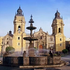
> South America
> Peru
> Cusco
> South America
> Peru
> Lima
> South America
> Peru
> Maps
> South America
> Peru
> Peru Heritage Sites
> Lima
EDITORS COMMENTS
This print showcases a remarkable map from the 15th to 16th centuries, depicting the Pacific coast along present-day Ecuador and Peru. The intricate details of this historical artifact provide a glimpse into the past, offering insights into the geography and settlements of that era. The map highlights several significant villages including Quito, Cajamarca, Cuzco, and Lima. Each village is marked with precision, allowing us to visualize their locations along the stunning coastline. The vibrant colors used in this print bring life to an otherwise ancient piece of cartography. What makes this particular map even more intriguing is its origin - it belongs to a private collection and was created by an unknown artist or cartographer. Despite its mysterious origins, it serves as a valuable resource for historians studying South American history. As we delve into this image's vertical composition, we are transported back in time when exploration and discovery were at their peak. It reminds us of Santiago Ortega's incredible journey through uncharted territories during his expeditions across America. While appreciating this photographical reproduction of such an extraordinary map, let us refrain from commercial use discussions as they do not pertain to the essence of preserving our rich heritage. Instead, let's focus on celebrating the beauty and significance encapsulated within this unique piece of history.
MADE IN THE USA
Safe Shipping with 30 Day Money Back Guarantee
FREE PERSONALISATION*
We are proud to offer a range of customisation features including Personalised Captions, Color Filters and Picture Zoom Tools
SECURE PAYMENTS
We happily accept a wide range of payment options so you can pay for the things you need in the way that is most convenient for you
* Options may vary by product and licensing agreement. Zoomed Pictures can be adjusted in the Cart.