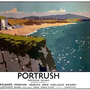
Home > Europe > United Kingdom > Northern Ireland > Aviation
Empire Air Routes: England-India-Malaya-Australia Route, Map A (colour litho)
")
![]()
Wall Art and Photo Gifts from Fine Art Finder
Empire Air Routes: England-India-Malaya-Australia Route, Map A (colour litho)
8659286 Empire Air Routes: England-India-Malaya-Australia Route, Map A (colour litho) by English School, (20th century); Private Collection; (add.info.: England-India-Malaya-Australia Route, Map A. Illustration for one of a set of cigarette cards on the subject of Empire Air Routes, issued by Lambert & Butler in 1936.); © Look and Learn
Media ID 38496996
© © Look and Learn / Bridgeman Images
Australia Australia 1930 1939 Years 30 30s 1930 1939 Years 30s 19301939 1933 34 Asiae Australians Years 1930 Years 30 Years Thirty
FEATURES IN THESE COLLECTIONS
> Arts
> Artists
> I
> Indian School Indian School
> Arts
> Artists
> I
> Irish School Irish School
> Asia
> India
> Related Images
> Europe
> Republic of Ireland
> Maps
> Europe
> United Kingdom
> England
> Aviation
> Europe
> United Kingdom
> England
> Maps
> Europe
> United Kingdom
> Maps
> Europe
> United Kingdom
> Northern Ireland
> Aviation
> Europe
> United Kingdom
> Northern Ireland
> Maps
> Fine Art Finder
> Artists
> English School
EDITORS COMMENTS
This vibrant and detailed map print showcases the Empire Air Routes from England to India, Malaya, and Australia. Created in the 20th century as part of a set of cigarette cards on the subject of Empire Air Routes, this illustration captures the excitement and adventure of early aviation.
The intricate lines and colors highlight the vast expanse of territory covered by these air routes, connecting distant lands across continents. The careful attention to detail in depicting each destination reflects the importance and significance of these routes in fostering connections between nations within the British Empire.
As we gaze upon this historical map, we are transported back to a time when air travel was still a novel and daring endeavor. The names of cities and countries evoke images of exotic locales and far-flung destinations waiting to be explored.
This print serves as a reminder of the pioneering spirit that drove early aviators to push boundaries and conquer new frontiers in aviation. It is a testament to human ingenuity and ambition, capturing a moment in history when the world seemed both vast yet interconnected through the marvels of flight.
MADE IN THE USA
Safe Shipping with 30 Day Money Back Guarantee
FREE PERSONALISATION*
We are proud to offer a range of customisation features including Personalised Captions, Color Filters and Picture Zoom Tools
SECURE PAYMENTS
We happily accept a wide range of payment options so you can pay for the things you need in the way that is most convenient for you
* Options may vary by product and licensing agreement. Zoomed Pictures can be adjusted in the Cart.