Fraud Blocker Skip to main content

Home > Design Pics > Vintage Maps

Vintage Maps Collection (#7)

507 Items

We are proud to offer this selection in partnership with Design Pics

Background imageVintage Maps Collection: Map Of Africa In The 17Th Century. Nova Africa Descriptio, Published In Amsterdam In 1660S By

Map Of Africa In The 17Th Century. Nova Africa Descriptio, Published In Amsterdam In 1660S By Dutch Cartographer Frederik De Wit

Background imageVintage Maps Collection: Map Of Ladysmith And Surrounding Heights Circa. 1900. From The Book South Africa And The Transvaal

Map Of Ladysmith And Surrounding Heights Circa. 1900. From The Book South Africa And The Transvaal War By Louis Creswicke, Published 1900

Background imageVintage Maps Collection: Plan Of Site Of The Engagement At Spion Kop. From The Book South Africa And The Transvaal War By

Plan Of Site Of The Engagement At Spion Kop. From The Book South Africa And The Transvaal War By Louis Creswicke, Published 1900

Background imageVintage Maps Collection: Irish Free State And Northern Ireland. From Bacons Excelsior Atlas Of The World

Irish Free State And Northern Ireland. From Bacons Excelsior Atlas Of The World, Published Circa 1930

Background imageVintage Maps Collection: India Circa 1930. Before Partition. From Bacons Excelsior Atlas Of The World, Published Circa 1930

India Circa 1930. Before Partition. From Bacons Excelsior Atlas Of The World, Published Circa 1930

Background imageVintage Maps Collection: The Holy Land In Biblical Times. From Bacons Excelsior Atlas Of The World, Published Circa 1930

The Holy Land In Biblical Times. From Bacons Excelsior Atlas Of The World, Published Circa 1930

Background imageVintage Maps Collection: The Balkan States Between The First And Second World Wars. From Bacons Excelsior Atlas Of The World

The Balkan States Between The First And Second World Wars. From Bacons Excelsior Atlas Of The World, Published Circa 1930

Background imageVintage Maps Collection: Map Of Scene Of Action During The Battle Of Majuba Hill, Near Volksrust, South Africa

Map Of Scene Of Action During The Battle Of Majuba Hill, Near Volksrust, South Africa, During The First Boer War. From The Book South Africa And The Transvaal War, Volume 1 By Louis Creswicke

Background imageVintage Maps Collection: Map Of Zululand And Adjoining Portions Of Natal At The End Of The 19Th Century

Map Of Zululand And Adjoining Portions Of Natal At The End Of The 19Th Century. From The Book South Africa And The Transvaal War, Volume 1 By Louis Creswicke, Published 1900

Background imageVintage Maps Collection: General Map Of British South Africa. From The Book South Africa And The Transvaal War

General Map Of British South Africa. From The Book South Africa And The Transvaal War, Volume 1 By Louis Creswicke, Published 1900

Background imageVintage Maps Collection: Map Showing The Site Of The Siege Of Badajoz, Spain 1812. From The Book How England Saved Europe

Map Showing The Site Of The Siege Of Badajoz, Spain 1812. From The Book How England Saved Europe, The Story Of The Great War, 1793-1815 Published 1909

Background imageVintage Maps Collection: Map Showing The Site Of The Battle Of Corunna, Galicia, Spain, 16 January 1809

Map Showing The Site Of The Battle Of Corunna, Galicia, Spain, 16 January 1809. From The Book How England Saved Europe, The Story Of The Great War, 1793-1815 Published 1909

Background imageVintage Maps Collection: Map Of German South West Africa, Scene Of One Of Britains Campaigns

Map Of German South West Africa, Scene Of One Of Britains Campaigns, Showing Walfish Bay And Keetmanshoop. From The Illustrated War News Published 1915

Background imageVintage Maps Collection: Map Of German East Africa, Showing Jassin, Scene Of One Of Britains Campaigns

Map Of German East Africa, Showing Jassin, Scene Of One Of Britains Campaigns. From The Illustrated War News Published 1915

Background imageVintage Maps Collection: Map Of The Cameroons, Scene Of One Of Britains Campaigns During World War One

Map Of The Cameroons, Scene Of One Of Britains Campaigns During World War One. From The Illustrated War News Published 1915

Background imageVintage Maps Collection: Map Of Turkey, Arabia And Persia By Guillaume De L isle, Revised By John Senex And Published In

Map Of Turkey, Arabia And Persia By Guillaume De L isle, Revised By John Senex And Published In The New General Atlas Of 1721 By Daniel Browne, Thomas Taylor, John Darby, John Senex

Background imageVintage Maps Collection: Map Of Flanders By Cartographer Matthias Quad From His Fasciculus Geographicus. Later Hand Colouring

Map Of Flanders By Cartographer Matthias Quad From His Fasciculus Geographicus. Later Hand Colouring. Engraved And Published By Johannes Bussemacher, Cologne, 1608

Background imageVintage Maps Collection: Map Of Germany In 1815. From The Book Europe In The Nineteenth Century An Outline History

Map Of Germany In 1815. From The Book Europe In The Nineteenth Century An Outline History, Published 1916

Background imageVintage Maps Collection: Map Of Treasure Island. From The Book Treasure Island By R. L. Stevenson

Map Of Treasure Island. From The Book Treasure Island By R. L. Stevenson. Thomas Nelson & Sons Edition C. 1930
Map Of Treasure Island. From The Book Treasure Island By R.L. Stevenson. Thomas Nelson & Sons Edition C.1930

Background imageVintage Maps Collection: Phoenician Colonies And Area Of Influence In The Mediterranean 200 To 850 B. C

Phoenician Colonies And Area Of Influence In The Mediterranean 200 To 850 B. C. Green Shows Colonized Areas
Phoenician Colonies And Area Of Influence In The Mediterranean 200 To 850 B.C. Green Shows Colonized Areas. Red Shows Principal Routes Of Phoenician Commerce

Background imageVintage Maps Collection: Carthaginian Colonies And Area Of Influence In The Mediterranean 850 To 146 B. C

Carthaginian Colonies And Area Of Influence In The Mediterranean 850 To 146 B. C. From Historia De Las Naciones Published Circa 1921

Background imageVintage Maps Collection: Map Of America. Reduced Facsimile Of A Map From The Spanish Atlas Published In Messina, 1582

Map Of America. Reduced Facsimile Of A Map From The Spanish Atlas Published In Messina, 1582. From Science And Literature In The Middle Ages By Paul Lacroix Published London 1878

Background imageVintage Maps Collection: Map Of Taprobana Island. Reduced Facsimile Of A Map In Ptolemys Geography

Map Of Taprobana Island. Reduced Facsimile Of A Map In Ptolemys Geography, In The Latin Edition Of 1492. From Science And Literature In The Middle Ages By Paul Lacroix Published London 1878

Background imageVintage Maps Collection: The Three Theatres Of War On The Austro-Italian Frontier 1915. 1 = Trentino. 2 = Carnic Alps

The Three Theatres Of War On The Austro-Italian Frontier 1915. 1 = Trentino. 2 = Carnic Alps. 3 = Isonzo Front. From The Great World War A History Volume Iii, Published 1916

Background imageVintage Maps Collection: Old Engraving Of A Ship For An Ancient Map Made By A Benedictine Monk About 1740 From The Book The

Old Engraving Of A Ship For An Ancient Map Made By A Benedictine Monk About 1740 From The Book The Century Illustrated Monthly Magazine May To October 1883

Background imageVintage Maps Collection: Map Of German South-West Africa At Beginning Of First World War

Map Of German South-West Africa At Beginning Of First World War. From The Great World War A History Volume Iii, Published 1916

Background imageVintage Maps Collection: The Gallipoli Campaign. Map Illustrating Operations Of Allies Under Sir Ian Hamilton From The

The Gallipoli Campaign. Map Illustrating Operations Of Allies Under Sir Ian Hamilton From The Landing On April 25 To May 30 1915. From The Great World War A History Volume Iii, Published 1916

Background imageVintage Maps Collection: Map Of East Africa At Beginning Of First World War. From The Great World War A History Volume Iii

Map Of East Africa At Beginning Of First World War. From The Great World War A History Volume Iii, Published 1916

Background imageVintage Maps Collection: Map Of Egypt Aegyptus Antiqua Drawn And Engraved By Sydney Hall C. 1826

Map Of Egypt Aegyptus Antiqua Drawn And Engraved By Sydney Hall C. 1826
Map Of Egypt Aegyptus Antiqua Drawn And Engraved By Sydney Hall C.1826

Background imageVintage Maps Collection: Map Of Ireland In The Sixth Century From The Book The Church Of England A History For The People

Map Of Ireland In The Sixth Century From The Book The Church Of England A History For The People Published C. 1910
Map Of Ireland In The Sixth Century From The Book The Church Of England A History For The People Published C.1910

Background imageVintage Maps Collection: Partial Map Of Turkey Kurdistan Iraq Persia Middle East In 1890S From The Citizens Atlas Of The

Partial Map Of Turkey Kurdistan Iraq Persia Middle East In 1890S From The Citizens Atlas Of The World Published London Circa 1899

Background imageVintage Maps Collection: Partial Map Of Middle East In 1890S From The Citizens Atlas Of The World Published London Circa 1899

Partial Map Of Middle East In 1890S From The Citizens Atlas Of The World Published London Circa 1899

Background imageVintage Maps Collection: City Map Of Ancient Jerusalem From The Citizens Atlas Of The World Published London Circa 1899

City Map Of Ancient Jerusalem From The Citizens Atlas Of The World Published London Circa 1899

Background imageVintage Maps Collection: Partial Map Of Middle East Showing Red Sea, Persian Gulf Horn Of Africa Gulf Of Aden In 1890S From

Partial Map Of Middle East Showing Red Sea, Persian Gulf Horn Of Africa Gulf Of Aden In 1890S From The Citizens Atlas Of The World Published London Circa 1899

Background imageVintage Maps Collection: Ancient Palestine From The Citizens Atlas Of The World Published London Circa 1899

Ancient Palestine From The Citizens Atlas Of The World Published London Circa 1899

Background imageVintage Maps Collection: Map Of Spain And Portugal From Smiths General Atlas Published London 1850 By C

Map Of Spain And Portugal From Smiths General Atlas Published London 1850 By C. Smith Mapseller Number 172 The Strand

Background imageVintage Maps Collection: Map Showing Approximately The Semicircular Foothold Of Australians And New Zealanders Above Anzac

Map Showing Approximately The Semicircular Foothold Of Australians And New Zealanders Above Anzac Cove July 1915. From The Great World War A History Volume Iii, Published 1916

Background imageVintage Maps Collection: Map Of Asia Minor And Caucasus Region And Mesopotamia At Beginning Of First World War

Map Of Asia Minor And Caucasus Region And Mesopotamia At Beginning Of First World War. From The Great World War A History Volume Iii, Published 1916

Background imageVintage Maps Collection: Map Of The Roman Empire In Ad 117 From The National Encyclopaedia Published By William Mackenzie

Map Of The Roman Empire In Ad 117 From The National Encyclopaedia Published By William Mackenzie London Late 19Th Century

Background imageVintage Maps Collection: Map Of Ancient Rome From The National Encyclopaedia Published By William Mackenzie London Late

Map Of Ancient Rome From The National Encyclopaedia Published By William Mackenzie London Late 19Th Century

Background imageVintage Maps Collection: Plan Of Ephesus And Its Environs From Falkeners Ephesus With The Sites As Named By Edward Falkener

Plan Of Ephesus And Its Environs From Falkeners Ephesus With The Sites As Named By Edward Falkener From The Imperial Bible Dictionary Published By Blackie & Son Circa 1880S

Background imageVintage Maps Collection: 19Th Century Map Of Great Greece And Of The Islands Of Sardina And Corsica By Guillaume Delisle

19Th Century Map Of Great Greece And Of The Islands Of Sardina And Corsica By Guillaume Delisle 1675 To 1726

Background imageVintage Maps Collection: 18Th Century Map Of A Plan Of The City And Country Around About Algiers

18Th Century Map Of A Plan Of The City And Country Around About Algiers

Background imageVintage Maps Collection: The West Part Of Barbary Containing Fez Marocco Algier And Part Of Biledulgerid The Canary Islands

The West Part Of Barbary Containing Fez Marocco Algier And Part Of Biledulgerid The Canary Islands Etc. Map From Circa 1720 By Hermann Moll

Background imageVintage Maps Collection: A 19Th Century Map Of Africa Propria And Numidia

A 19Th Century Map Of Africa Propria And Numidia

Background imageVintage Maps Collection: 19Th Century Map Showing Provinces And Cities Of Roman Spain

19Th Century Map Showing Provinces And Cities Of Roman Spain

Background imageVintage Maps Collection: Map Of Andalusia Spain By Willem And Or Joannes Blaeu Published Amsterdam 1640

Map Of Andalusia Spain By Willem And Or Joannes Blaeu Published Amsterdam 1640

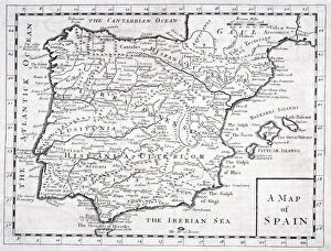
Background imageVintage Maps Collection: Map Of Roman Spain, C. 413

Map Of Roman Spain, C. 413
Map Of Roman Spain, C.413


All Professionally Made to Order for Quick Shipping


-

Why Choose Us?

We are a leading provider of Art Prints and Photo Gifts since 2003, working in partnership with a range of Sporting Clubs, Charities, Museums and Picture Libraries. A large share of profits from any of their images will go directly towards supporting that charity or club. Our archive of images is carefully curated to bring you a wide range of subjects, including landscapes, wildlife, architecture, and more. We ship from our partner labs in the UK, USA, EU (Netherlands) and Australia.
+

How do I place an order?

Ordering is quick & easy - Just follow 5 Simple Steps:
  1. Find your image: Use our search box or browse our online photo Collections to find the image you want.

  2. Choose your print format: Select your desired product and add it to your cart.

  3. Enter your details: If you're a returning customer, simply enter your email address and password, and we'll fill in your billing and shipping address details. All personal details are held securely and are fully GDPR compliant. As standard, we remove all Personally Identifiable Information after 12 months.

  4. Pay for your purchase: We use state-of-the-art security for online shopping and do not have access to your card details.

  5. Sit back and relax: We'll email you confirmation of your order and when it's dispatched. Registered customers can also track orders in the 'My Account' area.

+

How do I pay for an order?

You can pay for your order with most of the major credit and debit cards, or PayPal. For added security, major financial institutions process payment details separately and securely on our behalf. We do not have access to your online payment card details. Online payments are preferred however we do take phone orders. For UK customers only we accept cheques issued against a UK bank.
+

Is my data safe?

We take data security very seriously. We do not have access to your full card details and all payments are requested over a fully secure connection. Additionally, we fully comply with current European and GDPR legislation, and automatically remove all personal data after at most 12 months (unless you have an account with us and have signed in recently). We also have a strict opt-in policy and would never sell your personal details. Your data is only used to fulfill your order promptly and efficiently.
+

Is wall art ready to hang?

For quick and easy installation all wall art, including framed prints, canvas prints and metal prints are supplied with a ready to hang solution on the back. Generally, saw tooth hangers are applied as they allow wall art to hang flush against the wall. The serrated edge of the hanger prevents the frame from shifting or tilting when hung.
+

Are the photo prints fade resistant?

Yes, we use archival quality photo paper photographic paper for vivid reproduction Prints are an accurate representations of the original artwork, which is preserved for artistic character and authenticity. We guarantee they match previews shown on our web site