Fraud Blocker Skip to main content

Home > Asia > Georgia > Maps

Maps Collection (#5)

Maps of Georgia Asia are maps that show the physical features and political boundaries of the country

365 Items

Background imageMaps Collection: East India House, London (litho)

East India House, London (litho)
7185009 East India House, London (litho) by Malton, Thomas (1748-1804) (after); Private Collection; (add.info.: East India House, Leadenhall Street, Cit of London)

Background imageMaps Collection: Stevenss Auction Rooms, London (litho)

Stevenss Auction Rooms, London (litho)
7185978 Stevenss Auction Rooms, London (litho) by English School, (20th century); Private Collection; (add.info.: Stevenss Auction Rooms, 38 King Street, Covent Garden, London, founded in 1760)

Background imageMaps Collection: Former home of William Hogarth, Chiswick, London (litho)

Former home of William Hogarth, Chiswick, London (litho)
7201924 Former home of William Hogarth, Chiswick, London (litho) by Railton, Herbert (1857-1910) (after); Private Collection; (add.info.: Former home of English artist William Hogarth, Chiswick)

Background imageMaps Collection: The Oxfordshire Election, Chairing the Members, satire depicting English Whig politician George

The Oxfordshire Election, Chairing the Members, satire depicting English Whig politician George Bubb Dodington being
7148359 The Oxfordshire Election, Chairing the Members, satire depicting English Whig politician George Bubb Dodington being carried aloft by a crowd, 1754 (engraving) by Hogarth

Background imageMaps Collection: Burning a Prime Minister in Effigy, satire on the use of bribery

Burning a Prime Minister in Effigy, satire on the use of bribery and corruption by the Whig government of the Duke of
7148355 Burning a Prime Minister in Effigy, satire on the use of bribery and corruption by the Whig government of the Duke of Newcastle, 1756 (engraving) by English School

Background imageMaps Collection: Loyal Medal, a parody of the patriotic medal struck in commemoration of the Reform meeting held at

Loyal Medal, a parody of the patriotic medal struck in commemoration of the Reform meeting held at Greathead s
7148347 Loyal Medal, a parody of the patriotic medal struck in commemoration of the Reform meeting held at Greathead s, Guys Cliff, Warwick, 1797 (engraving) by English School

Background imageMaps Collection: Political Amusements for Young Gentlemen, or the Brentford Shuttlecock between Old Sarum

Political Amusements for Young Gentlemen, or the Brentford Shuttlecock between Old Sarum
7148344 Political Amusements for Young Gentlemen, or the Brentford Shuttlecock between Old Sarum and the Temple of St Stephen s

Background imageMaps Collection: The Head of the Poll; or, the Wimbledon Showman and His Puppet

The Head of the Poll; or, the Wimbledon Showman and His Puppet, caricature of British Whig politicians John Horne Tooke
7148339 The Head of the Poll; or, the Wimbledon Showman and His Puppet, caricature of British Whig politicians John Horne Tooke and Francis Burdett, 1807 (engraving) by English School

Background imageMaps Collection: The Hanoverian Horse and the British Lion, satire on the general election of 1784 depicting the Whig

The Hanoverian Horse and the British Lion, satire on the general election of 1784 depicting the Whig
7148316 The Hanoverian Horse and the British Lion, satire on the general election of 1784 depicting the Whig and Tory party leaders

Background imageMaps Collection: The Wits Last Stake; or, The Cobbling Voter and Abject Canvassers

The Wits Last Stake; or, The Cobbling Voter and Abject Canvassers, satire on Tory accusations against the Duchess of
7148315 The Wits Last Stake; or, The Cobbling Voter and Abject Canvassers, satire on Tory accusations against the Duchess of Devonshire of bribing voters while canvassing on behalf of the Whig

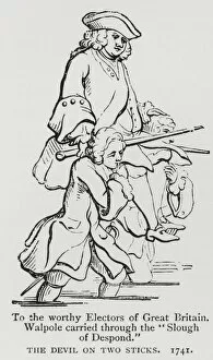
Background imageMaps Collection: The Devil on Two sticks, satire depicting Prime Minister Robert Walpole being carried across a

The Devil on Two sticks, satire depicting Prime Minister Robert Walpole being carried across a swamp by his supporters
7148361 The Devil on Two sticks, satire depicting Prime Minister Robert Walpole being carried across a swamp by his supporters in Parliament, 1741 (engraving) by Gravelot

Background imageMaps Collection: The Case is Altered, satire on the defeat of Sir Cecil Wray by Charles James Fox

The Case is Altered, satire on the defeat of Sir Cecil Wray by Charles James Fox
7148313 The Case is Altered, satire on the defeat of Sir Cecil Wray by Charles James Fox and Samuel Hood in the constituency of Westminster at the 1784 general election (engraving) by Rowlandson

Background imageMaps Collection: Middlesex Election, 1804. A Long Pull - a Strong Pull - and a Pull All Together, 1804 (engraving)

Middlesex Election, 1804. A Long Pull - a Strong Pull - and a Pull All Together, 1804 (engraving)
7148305 Middlesex Election, 1804. A Long Pull - a Strong Pull - and a Pull All Together, 1804 (engraving) by Gillray, James (1757-1815) (after); Private Collection; (add.info.: Middlesex Election)

Background imageMaps Collection: Two Pairs of Portraits, Presented to All the Unbiased Electors of Great Britain by John Horne

Two Pairs of Portraits, Presented to All the Unbiased Electors of Great Britain by John Horne Tooke, 1798 (engraving)
7148304 Two Pairs of Portraits, Presented to All the Unbiased Electors of Great Britain by John Horne Tooke, 1798 (engraving) by Gillray

Background imageMaps Collection: Scene from Night Thoughts, by English poet Edward Young (engraving)

Scene from Night Thoughts, by English poet Edward Young (engraving)
7149344 Scene from Night Thoughts, by English poet Edward Young (engraving) by Stothard, Thomas (1755-1834) (after); Private Collection; (add.info.: Scene from Night Thoughts)

Background imageMaps Collection: N is for nobleman (colour litho)

N is for nobleman (colour litho)
7149214 N is for nobleman (colour litho) by Dalziel Brothers (1815-1905) (after); Private Collection; (add.info.: N is for nobleman)

Background imageMaps Collection: King George III (engraving)

King George III (engraving)
7147312 King George III (engraving) by English School, (18th century) (after); Private Collection; (add.info.: King George III (1738-1820)

Background imageMaps Collection: American general and rifleman of the American Revolutionary War (engraving)

American general and rifleman of the American Revolutionary War (engraving)
7147309 American general and rifleman of the American Revolutionary War (engraving) by English School, (18th century) (after); Private Collection; (add.info)

Background imageMaps Collection: Scene from Night Thoughts, by English poet Edward Young (engraving)

Scene from Night Thoughts, by English poet Edward Young (engraving)
7149360 Scene from Night Thoughts, by English poet Edward Young (engraving) by Stothard, Thomas (1755-1834) (after); Private Collection; (add.info.: Scene from Night Thoughts)

Background imageMaps Collection: Battle of Bunker Hill and burning of Charlestown, Massachusetts, American Revolutionary War

Battle of Bunker Hill and burning of Charlestown, Massachusetts, American Revolutionary War, 17 June 1775 (engraving)
7147308 Battle of Bunker Hill and burning of Charlestown, Massachusetts, American Revolutionary War, 17 June 1775 (engraving) by English School

Background imageMaps Collection: Declaration of Independence of the American colonies from British rule, 4 July 1776 (engraving)

Declaration of Independence of the American colonies from British rule, 4 July 1776 (engraving)
7147307 Declaration of Independence of the American colonies from British rule, 4 July 1776 (engraving) by English School

Background imageMaps Collection: Early advertisements for Walter Churchmans chocolate, the patent rights for which were purchased

Early advertisements for Walter Churchmans chocolate, the patent rights for which were purchased by Joseph Fry in 1761
7157206 Early advertisements for Walter Churchmans chocolate, the patent rights for which were purchased by Joseph Fry in 1761 (litho) by English School

Background imageMaps Collection: January: skating (colour litho)

January: skating (colour litho)
7157297 January: skating (colour litho) by English School, (19th century); Private Collection; (add.info.: January: skating)

Background imageMaps Collection: Entrance to the Royal Pavilion, Brighton, Sussex (colour litho)

Entrance to the Royal Pavilion, Brighton, Sussex (colour litho)
7153949 Entrance to the Royal Pavilion, Brighton, Sussex (colour litho) by English School, (19th century); Private Collection; (add.info.: Entrance to the Royal Pavilion, Brighton, Sussex)

Background imageMaps Collection: Prince Frederick, Duke of York and Albany (engraving)

Prince Frederick, Duke of York and Albany (engraving)
7154005 Prince Frederick, Duke of York and Albany (engraving) by English School, (19th century); Private Collection; (add.info.: Prince Frederick, Duke of York and Albany (1763-1827)

Background imageMaps Collection: James Hawkins-Whitshed, British admiral (engraving)

James Hawkins-Whitshed, British admiral (engraving)
7150336 James Hawkins-Whitshed, British admiral (engraving) by Northcote, James (1746-1831) (after); Private Collection; (add.info.: James Hawkins-Whitshed (1762-1849)

Background imageMaps Collection: Sir John Lockhart-Ross, British admiral (engraving)

Sir John Lockhart-Ross, British admiral (engraving)
7150328 Sir John Lockhart-Ross, British admiral (engraving) by Reynolds, Joshua (1723-92) (after); Private Collection; (add.info.: Sir John Lockhart-Ross (1721-1790)

Background imageMaps Collection: Family consulting road map on Georgia highway, USA (B&W)

Family consulting road map on Georgia highway, USA (B&W)
Retrofile, CA29738

Background imageMaps Collection: Map of Asia, early 19th century

Map of Asia, early 19th century
6337920 Map of Asia, early 19th century by English School, (19th century); (add.info.: Map of Asia, early 19th century. Showing Asia Minor, Arabia, Persia, Siberia, Tartary, Thibet, Hindoostan)

Background imageMaps Collection: Map from Red Books, for Mogenhanger in Bedfordshire

Map from Red Books, for Mogenhanger in Bedfordshire
495319 Map from Red Books, for Mogenhanger in Bedfordshire, a Seat of Godfrey Thornton Esq. 1792 (w/c on paper) (see also 495318 and 497306-7) by Repton

Background imageMaps Collection: Vrbium Londini et West-Monasterii nec non suburbii Southwark

Vrbium Londini et West-Monasterii nec non suburbii Southwark
6201308 Vrbium Londini et West-Monasterii nec non suburbii Southwark, 1736 (hand-coloured engraving_ by German School, (18th century); 58x78 cm; New York Public Library

Background imageMaps Collection: The British Virgin Islands, engraved by Georges-Louis Le Rouge

The British Virgin Islands, engraved by Georges-Louis Le Rouge
5648405 The British Virgin Islands, engraved by Georges-Louis Le Rouge, 1779 (hand-coloured engraving) by Jefferys, Thomas (c.1719-71) (after); 44x58 cm; Boston Public Library, Boston, Massachusetts

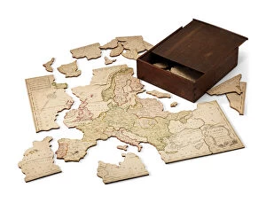
Background imageMaps Collection: Europe divided into its Kingdoms, c. 1766 (hand-coloured engraved sheet mounted on wood)

Europe divided into its Kingdoms, c. 1766 (hand-coloured engraved sheet mounted on wood)
6244298 Europe divided into its Kingdoms, c.1766 (hand-coloured engraved sheet mounted on wood) by Spilsbury, John (1739-69); 453x480 cm; Private Collection; (add.info)

Background imageMaps Collection: The Colonies of North America at the Declaration of Independence (colour litho)

The Colonies of North America at the Declaration of Independence (colour litho)
PNP468338 The Colonies of North America at the Declaration of Independence (colour litho) by Stanford, Edward (1827-1904); Private Collection; (add.info)

Background imageMaps Collection: Map of Asia, early 19th century

Map of Asia, early 19th century. Showing Asia Minor, Arabia, Persia, Siberia, Tartary, Thibet, Hindoostan, Further India, China, Formosa, Japan. Handcoloured copperplate engraving from Rev

Background imageMaps Collection: Scenes from the history of the United States

Scenes from the history of the United States
William Penn making a treaty in 1682 with the Lenape Native Americans 82, Benjamin Franklin drawing electricity from the sky in a thunderstorm 83

Background imageMaps Collection: A Map of the Countries Thirty Degrees round the North Pole

A Map of the Countries Thirty Degrees round the North Pole
NBY332292 A Map of the Countries Thirty Degrees round the North Pole, from Atlas to Crutwells Gazetteer by Clement Crutwell (1743-1808) published London, 1799 (coloured engraving) by Neele

Background imageMaps Collection: Colony of Georgia, America, 1733 (litho)

Colony of Georgia, America, 1733 (litho)
PNP351109 Colony of Georgia, America, 1733 (litho) by American School, (18th century); Private Collection; (add.info.: the earliest map of Georgia; ); Peter Newark American Pictures; American

Background imageMaps Collection: Francis Basset, 1st Baron of Dunstanville, 1778 (oil on canvas)

Francis Basset, 1st Baron of Dunstanville, 1778 (oil on canvas)
SCP38083 Francis Basset, 1st Baron of Dunstanville, 1778 (oil on canvas) by Batoni, Pompeo Girolamo (1708-87); 221x157 cm; Prado, Madrid

Background imageMaps Collection: Woman Reading a Book

Woman Reading a Book
RAF63510 Woman Reading a Book by Schall, Jean-Frederic (1752-1825); Private Collection; (add.info.: French rococo painter. ); Photo eRafael Valls Gallery, London, UK; French, out of copyright

Background imageMaps Collection: A View of the Glorious Action of Dettingen, 16th-27th June 1743, engraved by I

A View of the Glorious Action of Dettingen, 16th-27th June 1743, engraved by I
NAM261106 A View of the Glorious Action of Dettingen, 16th-27th June 1743, engraved by I. Pano, published by Robert Wilkinson, London, 1743 (coloured engraving) by Daremberg, F

Background imageMaps Collection: Views of St Martins le Grand, the General Post Office and Aldersgate Street, c

Views of St Martins le Grand, the General Post Office and Aldersgate Street, c
GHL430737 Views of St Martins le Grand, the General Post Office and Aldersgate Street, c.1838 (engraving) by Tallis, John (1815-76); width: 44 cm; Guildhall Art Gallery

Background imageMaps Collection: Map of the Colonies of North America at the time of the Declaration of Independence

Map of the Colonies of North America at the time of the Declaration of Independence
PNP316579 Map of the Colonies of North America at the time of the Declaration of Independence (colour engraving) by American School; Private Collection; (add.info)

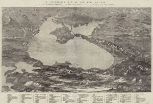
Background imageMaps Collection: A Picturesque Map of the Seat of War, in the Danubian Provinces, Turkey, Asia Minor, Southern Russia

A Picturesque Map of the Seat of War, in the Danubian Provinces, Turkey, Asia Minor, Southern Russia
1607993 A Picturesque Map of the Seat of War, in the Danubian Provinces, Turkey, Asia Minor, Southern Russia, and the Crimea (engraving) by English School

Background imageMaps Collection: Map of the coast of New Zealand, illustration from

Map of the coast of New Zealand, illustration from
3610747 Map of the coast of New Zealand, illustration from A journal of a voyage to the South Seas : in His Majestys ship, the Endeavour, 1794 (hand-coloured engraving) by Parkinson

Background imageMaps Collection: Map of the Carolinas with part of Georgia (engraving)

Map of the Carolinas with part of Georgia (engraving)
AQS251295 Map of the Carolinas with part of Georgia (engraving) by American School, (19th century); American Antiquarian Society, Worcester, Massachusetts, USA; (add.info.: engraved for Dr)

Background imageMaps Collection: Panorama of the Seat of War: Birds Eye View Of North And South Carolina And Part Of

Panorama of the Seat of War: Birds Eye View Of North And South Carolina And Part Of
497534 Panorama of the Seat of War: Birds Eye View Of North And South Carolina And Part Of Georgia, 1861 (colour litho) by Bachmann, John (fl.1850-77); 58x77 cm; Gilder Lehrman Collection, New York

Background imageMaps Collection: Town Plan of Savannah, c. 1733 (pen & ink on paper)

Town Plan of Savannah, c. 1733 (pen & ink on paper)
3964034 Town Plan of Savannah, c.1733 (pen & ink on paper) by American School, (18th century); 35.2x39.5 cm; By kind permission of the Earl of Leicester and the Trustees of the Holkham Estate;


All Professionally Made to Order for Quick Shipping


-

Maps Collection

Maps of Georgia Asia are maps that show the physical features and political boundaries of the country. The maps include rivers, mountains, lakes, cities, towns and villages. They also show roads and other transportation routes as well as national parks and protected areas. They can useful for travelers who want to explore the country or for those who need to plan a route or find a specific location and can also be used by businesses to identify potential markets or sources of raw materials. Maps of Georgia Asia provide an invaluable resource for anyone interested in learning more about this fascinating region of the world.
+

Our beautiful Wall Art and Photo Gifts include Framed Prints, Photo Prints, Poster Prints, Canvas Prints, Jigsaw Puzzles, Metal Prints and so much more

The Maps of Georgia Asia collection is a stunning assortment of wall art and framed prints available at Media Storehouse. Our collection showcases the beauty and intricacy of maps depicting the country of Georgia in Asia, featuring various regions, cities, and landmarks. The maps are created using high-quality printing techniques that capture every detail with precision and clarity. Each piece in our collection is unique, offering a glimpse into the rich history and culture of Georgia. From ancient cartography to modern-day satellite imagery, these maps provide an excellent opportunity for anyone interested in geography or travel to explore this fascinating region. Whether you're looking for a decorative addition to your home or office or searching for an educational tool to teach children about geography, the Maps of Georgia Asia collection has something for everyone. With its exceptional quality and attention to detail, it's no wonder why our collection remains popular among customers worldwide.
+

What are Maps of Georgia Asia art prints?

Maps of Georgia Asia art prints are a collection of high-quality reproductions of antique and contemporary maps that depict the region of Georgia in Asia. These maps showcase the intricate details and unique features of this beautiful country, including its cities, towns, rivers, mountains, and other geographical landmarks. The Maps of Georgia Asia art prints are perfect for anyone who loves history or geography or wants to add a touch of sophistication to their home or office decor. They come in various sizes and styles to suit different tastes and preferences. Whether you're looking for a vintage map from the 19th century or a modern-day satellite image, we have an extensive selection that will meet your needs. Each print is carefully crafted using premium materials to ensure it lasts for years without fading or losing its vibrancy. Maps of Georgia Asia art prints are an excellent investment for anyone who appreciates fine art and wants to celebrate the beauty and diversity of this fascinating region.
+

What Maps of Georgia Asia art prints can I buy from Media Storehouse?

We offer a wide range of Maps of Georgia Asia art prints that you can purchase. These maps showcase the geography, topography, and landmarks of Georgia in intricate detail. You can choose from antique or modern styles, depending on your preference. Some popular options include vintage maps that depict the country's historical borders and cities, as well as contemporary maps that highlight its current infrastructure and transportation networks. Additionally, there are detailed satellite images available that provide an aerial view of Georgia's terrain. These art prints come in various sizes to fit any space in your home or office. They make excellent gifts for anyone interested in cartography, history, or travel. Whether you're looking to decorate your living room with a unique piece of artwork or add some character to your workspace with a map print, we have something for everyone who loves exploring the world through cartography.
+

How do I buy Maps of Georgia Asia art prints?

To buy Maps of Georgia Asia art prints from Media Storehouse, you can browse our extensive collection online. Simply search for "Maps of Georgia Asia" in the search bar on our website and select the print that catches your eye. Once you have found a print that you like, click on it to view more details about the product. From there, you will be able to choose the size and format of your print. You may also have options for framing or mounting your artwork if desired. Once you have made all necessary selections, simply add the item to your cart and proceed to checkout. We accept various payment methods including credit card and PayPal. After completing your purchase, they will process your order promptly so that it can be shipped out as soon as possible. Buying Maps of Georgia Asia art prints from Media Storehouse is a simple and straightforward process that allows you to easily acquire beautiful pieces of artwork for display in your home or office.
+

How much do Maps of Georgia Asia art prints cost?

We offer a wide range of Maps of Georgia Asia art prints that vary in price depending on the size and type of print you choose. Our collection includes vintage maps, modern designs, and everything in between. We strive to provide high-quality prints at affordable prices so that everyone can enjoy beautiful artwork in their home or office. Whether you're looking for a small print to add some color to your space or a large statement piece, we have options for every budget. Our team is dedicated to providing excellent customer service and ensuring that our customers are satisfied with their purchases. If you're interested in purchasing one of our Maps of Georgia Asia art prints, please browse our selection online or contact us for more information.
+

How will my Maps of Georgia Asia art prints be delivered to me?

Your Maps of Georgia Asia art prints will be delivered to you with utmost care and attention. We use high-quality packaging materials to ensure that your artwork arrives in pristine condition. Our team of experts carefully inspects each print before it is shipped out, so you can rest assured that you are receiving a product of the highest quality. We work with trusted shipping partners who provide reliable and efficient delivery services. Your order will be dispatched promptly, and we will keep you informed every step of the way regarding its progress. We take great pride in our customer service, and we strive to make sure that every aspect of your experience with us is positive. If for any reason you are not completely satisfied with your purchase or have any questions about the delivery process, please do not hesitate to contact us – our friendly team is always happy to help.