Home > Europe > Russia > Maps
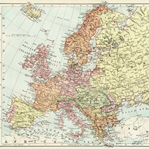
Map showing the Russian advance in October 1943, the Red Army launched an offensive of a 1,000 mile front from Vitebsk to the Taman Peninsula, Russia, wiping out German bridgeheads on the way. From The War in Pictures, Fifth Year.
![]()

Wall Art and Photo Gifts from Design Pics
Map showing the Russian advance in October 1943, the Red Army launched an offensive of a 1,000 mile front from Vitebsk to the Taman Peninsula, Russia, wiping out German bridgeheads on the way. From The War in Pictures, Fifth Year.
Map showing the Russian advance in October 1943, the Red Army launched an offensive of a 1,000 mile front from Vitebsk to the Taman Peninsula, Russia, wiping out German bridgeheads on the way. From The War in Pictures, Fifth Year
Design Pics offers Distinctively Different Imagery representing over 1,500 contributors
Media ID 36527421
© Ken Welsh / Design Pics
20th Century Conflict German Launched Offensive Russia Second World War Showing Warfare Wartime World War Two Wwii Red Army Vitebsk
FEATURES IN THESE COLLECTIONS
> Design Pics
> Art Images - Mar 04, 2024
> Maps and Charts
> Early Maps
> Maps and Charts
> Related Images
> Maps and Charts
> World
EDITORS COMMENTS
Map Showing the Russian Advance: October 1943 - The Red Army's Offensive on a 1,000 Mile Front This vintage map print, taken from "The War in Pictures, Fifth Year," illustrates the significant military advance made by the Red Army during October 1943. The map spans from Vitebsk in the north to the Taman Peninsula in the south, marking a 1,000-mile front where the Soviet forces launched an offensive against the German army. The Red Army's strategic offensive, which began in the summer of 1943, aimed to wipe out German bridgeheads and gain ground in the Eastern Front of World War II. This map highlights the successful progress made by the Soviet forces, as they pushed back the German army and reclaimed vast territories. The intricate details of the map, with its engraved lines and annotations, show the strategic importance of key locations, such as major cities, rivers, and railroads. The map also indicates the movements of both the Red Army and the German forces, providing a visual representation of the intense and dynamic nature of the conflict. As a historical artifact, this map offers valuable insights into the Second World War, allowing us to better understand the strategic decisions made by the military leaders of the time and the impact of their actions on the course of the war. The map is a testament to the resilience and determination of the Red Army, which played a crucial role in the eventual defeat of Nazi Germany. This archival map print is an essential addition to any history or military collection, providing a unique and captivating perspective on a pivotal moment in 20th-century world history.
MADE IN THE USA
Safe Shipping with 30 Day Money Back Guarantee
FREE PERSONALISATION*
We are proud to offer a range of customisation features including Personalised Captions, Color Filters and Picture Zoom Tools
SECURE PAYMENTS
We happily accept a wide range of payment options so you can pay for the things you need in the way that is most convenient for you
* Options may vary by product and licensing agreement. Zoomed Pictures can be adjusted in the Cart.


